- Jubilee Parkway
Infobox Bridge
bridge_name = Jubilee Parkway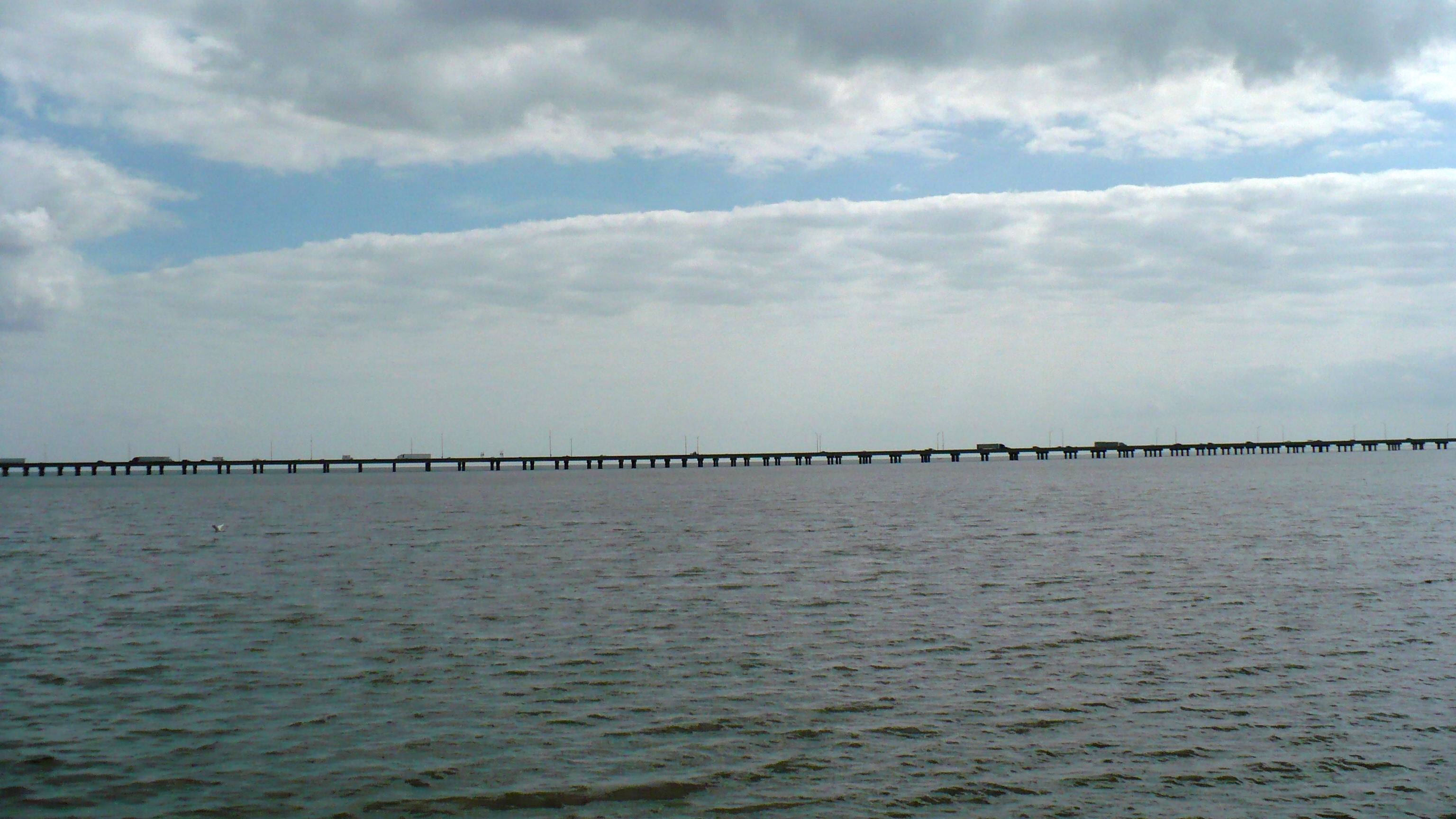
caption = The Jubilee Parkway as seen fromMeaher State Park .
official_name =
carries = 4 lanes ofInterstate 10
crosses =Mobile Bay
locale =Mobile, Alabama
maint =
id =
design =Girder bridge
mainspan =
length = convert|7.5|mi|km|1
width =
height =
load =
clearance =
below =
traffic =
begin =
complete =
open = 1978
closed =
toll =
map_cue =
map_
map_text =
map_width =
coordinates =
lat =
long =The Jubilee Parkway is a pair of parallel concrete
viaduct bridge s that carry Interstate 10 acrossMobile Bay from theGeorge Wallace Tunnel inMobile, Alabama eastbound to Spanish Fort/Daphne, Alabama . The bridges are similar in design to theI-10 Twin Span Bridge nearNew Orleans, Louisiana . Each of the two bridges is two lanes wide, for a total of four lanes, and convert|7.5|mi|km|1 long. The parkway was completed in 1978cite web|title="History"|work="Rivers of Alabama: Mobile Bay"|url=http://www.riversofalabama.org/Mobile%20Bay/M_History.htm|accessdate=2007-12-28] and crosses the northern portion of Mobile Bay, running roughly parallel to the nearbyBattleship Parkway .cite web|title="Mobile"|work="Mobile @ SouthEastRoads"|url=http://www.southeastroads.com/mobile.html|accessdate=2007-12-28] It was named for the jubilee phenomena that occurs intermittently in Mobile Bay, but is commonly referred to locally and in the media as the "Bayway".cite web|title="Interstate 10 Eastbound"|work="Alabama: SouthEastRoads"|url=http://www.southeastroads.com/i-010b_al.html|accessdate=2007-12-28]Controversial expansion
Since 2001, the Alabama Department of Transportation (ALDOT) has planned to expand the parkway to a total of eight lanes in addition to a connecting
cable-stayed bridge with a main span convert|1250|ft|m|0 long and convert|190|ft|m|0 high that would bypass theGeorge Wallace Tunnel . This is intended to eliminate the current traffic bottleneck on I-10 at the tunnel, but is very controversial locally due to the proposed bridge's potential visual and economic impact on the city. The arguments against the bridge have focused on the bridge's height of roughly convert|500|ft|m|0, taller than any other structure in the city except for theRSA Battle House Tower , as potentially overshadowing the city. The potential economic impact is that, with less than convert|190|ft|m|0 of clearance under the bridge, it would hamper large ships and projects from thePort of Mobile and prevent largecruise ship s from accessing the newly built Alabama Cruise Terminal.cite web|title="Bridging the divide or the snarl ahead?"|work="Mobile Bay Times"|url=http://mobilebaytimes.com/bridge.html|accessdate=2007-12-28]Incidents
On the morning of
20 March 1995 the parkway was the scene of one of the largestmulti-vehicle collision s inUnited States history. The accident involved around 200 vehicles and resulted in more than 90 injuries and 1 death. The causative agent was determined to be fog from Mobile Bay.cite web|title="Performance of Satellite Fog Detection Techniques"|work="National Weather Association"|url=http://www.nwas.org/ej/pdf/2006-EJ3.pdf|accessdate=2007-12-28]References
Wikimedia Foundation. 2010.