- Dunwell, Nebraska
-
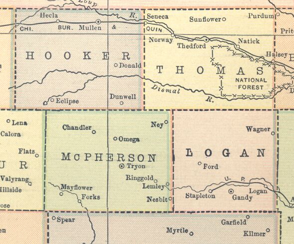
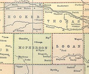 Dunwell's location according to a 1914 atlas
Dunwell, now a ghost town, was a community in Hooker County, Nebraska, United States. A post office was operated in Dunwell for over thirty years, opening on 27 January 1900 and closing in 1934. The community's elevation and geographic coordinates are unknown,[1] although a 1914 map reveals that it lay midway between Mullen and Tryon.
References
- ^ Geographic Names Information System Feature Detail Report, Geographic Names Information System, 1999-05-03. Accessed 2007-12-26.
Municipalities and communities of Hooker County, Nebraska Village 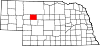
Ghost town Dunwell
Categories:- Nebraska geography stubs
- United States ghost town stubs
- Geography of Hooker County, Nebraska
- Ghost towns in Nebraska
Wikimedia Foundation. 2010.