- San Ġwann
Towns (Malta)
name = L-Imsieraħ(San Ġwann)
coa = SanGwannHTML.gif
official_name = San Ġwann
other_names = Msieraħ (code: SĠN)
inhabitants_name = ġwanniż (m), ġwanniża (f), ġwanniżi (pl)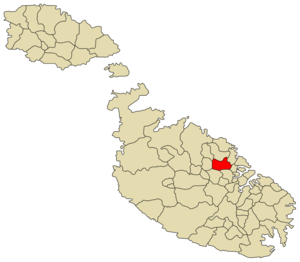
latitude = 35°54 '34"
longitude = 14°28 '43"
area = 2.6
population_total = 12,737 (7th largest locality)
population_density = 4,866
borders =Swieqi ,San Ġiljan ,Gżira ,Birkirkara ,Msida ,Iklin ,Għargħur
saint =Our Lady of Lourdes
feast = First Sunday of August
mayor =Joseph Borg (MLP)San Ġwann (English: San Giovanni) is the 7th-largest town in
Malta , with a population of 12,630 (Nov 2005) behind Birkirkara (21,775), Mosta (18,676), Qormi (16,576), Zabbar (14,694), St. Paul's Bay (13,619) and Sliema (12,993).History
The San Ġwann suburb is mostly made up of relatively modern buildings having been established as a parish only in 1965. However, the few scattered archeological remains found in the region suggest that San Ġwann has an ancient history which is woven into the national history of Malta.
The oldest human remains in the locality are the cart ruts close to Sant Andrija zone. The dating of the cart ruts, found in many other localities in Malta, has not been definitely established but have been dated to the pr-Punic Period and have been assumed to have been carved out during the Bronze Age period dated to 2300-1000 BC. Their function similarly has not been elucidated but has always been assumed to be transport facilities.
The presence of these prehistoric cart ruts suggests that the region may have housed an agricultural community who made full use of the then fertile valleys of Wied Ghomor, Wied il-Ballut and Wied Ghollieqa. These prehistoric inhabitants may have lived in caves similar to those behind the Tal-Mensija Sanctuary.
This agricultural community continued with its activities in the region throughout the subsequent centuries. Roman period remains excavated from the region included a number of tombs and a covered cistern arresting to an active human community. However, the most renowned period archaeological remain is the "Roman Tower" of Ta’ Cieda. This tower was one of a series of eight defensive towers built throughout Malta around the 3rd century AD. This tower further arrests to a continuing human presence in the region since it was used as a cemetery during the Arab period.
The Arab links to the region can also be seen in the various Semitic names given to various localities as arrested by various medieval notarial documents. The old names given to the region – Tal-Gharghar, and L-Imsierah – are such examples. These names give us an indication of the habitat of the region during this distant age. The old name of “Tal-Gharghar” suggests that the region was enriched by a flourishing woodland area of juniper trees which we known were prevalent during the Arab period and were continually cut down for their wood. The alternative name of “L-Imsierah” suggests open spaces reflecting the high ground rise of the locality. During the medieval period, the region was apparently inhabited by at least two communities living at Rahal Tigan [close to Wied Ghollieqa] and Rahal Ger [close to Xwieki between Tal-Gharghar and Naxxar] .
Other Semitic locality names recorded in medieval notarial documents include: the valleys – Wied Ghomor, Wied il-Ballut and Wied Ghollieqa – and the field localities – il-Kappara, Habel il-Ghasfur, il-Hirba ta’ l-Imnajdar, ta’ Gharnuqa, l-Andar ta’ Zerqa, tal-Berbri, ta’ Gulbien, tal-Ghul, tad-Dwiemes, Habel il-Hofor, il-Hofra tad-Demus, il-Hrejba ta’ Bajdun, tal-Milfuq, tan-Nigem, Bir Werc, tal-Minfes, ta’ Xmiexi, and others.
The Gharghar [sive` Arar] region during the Medieval period also apparently housed the parochial church of St. Helena, situated possibly close to the Ta’ Cieda Tower. Abandoned during the 14th century, the remains of this church were still extant in 1575 when the Apostolic Visitor Mgr Petrus Dusina wrote his report. Dusina wrote “Sanctae Helenae – Visitavit aliam Ecclesiam ruralem sub vocabulo Sanctae Helenae constructam in pertinentia Bircalcariae in contrata nuncupata Arar, quae alias dicitur fuisse parrochialis Ecclesia, habet altare, caret rectore, introitibus, portis ligneis, et omnibus alijs necessarijs ex devotione Michael Borgiu in eadem die festivitatis celebrare facit missam tantum, non celebretur amplius, nisi postquam fuerint factae portae ligneae.” Other churches located in the Gharghar region mentioned by Dusina were those dedicated to Santa Margarita, Sant Andrea, San Bartholomew and San Leonardo. The latter cave-chapel, located in the Mensija suburb, is today known as the Chapel of the Annunciation [Lunziata Chapel] and is associated with a popular medieval legend. The locality during this period fell under the jurisdiction of the Birkirkara Parish.
The ceding of the Maltese Islands in 1530 to the Order of St. John and the aftermath of the 1565 Great Siege brought a degree of safety from the recurrent Turkish raids that plagued the inhabitants of the San Ġwann region in previous decades. This led to an augmentation in the population living in the locality as evidenced by the establishment of further chapels including that dedicated to San Ġwann tal-Gharghar [c.1646] and that dedicated to Sts Philip and James [c.1730] . Other buildings built during the time of the knights included the protected farm-building – It-Torri ta’ Lanzun [c.1713] .
Overlooking the Grand Harbour, the Gharghar rise became an important outpost for the Maltese troops blockading the French forces within the city in 1798-1800. The Ta’ Xindi Farmhouse, located in the Kappara suburb, was made the headquarters of the distinguished Maltese Regimental Captain Vincenzo Borg. The outpost was manned by not less than 568 soldiers hailing from Birkirkara and Mosta. In a military action undertaken on the 2nd September 1798, this battalion captured two 18-pound cannons one of which was used to strengthen the Kappara outpost.
The relative calm of the 19th century allowed the community living at the Gharghar locality to augment itself. The area was little affected by the Second World War, though Torri Lanzun served as an observation post for advancing planes and was damaged during enemy action. The locality featured however in the plans of the British Colonial Office in its overall defence scheme covering the possible eventuality of a possible nuclear attack engendered by the World politics post-War period. The Colonial Office established the Civil Defence Corps in 1950 and, to ensure an adequate grain supply in the advent of hostilities, initiated the building of eight underground flour mills in Malta and Gozo. One such mill with a silo storage capacity of some 1000 tons of wheat is located behind the San Ġwann State Primary School.
The mentioned Torri Lanzun is now the seat of the
Military and Hospitaller Order of Saint Lazarus of Jerusalem . San Ġwann also hosts theChancery of the Grand Priory of the Mediterranean of theHospitaller Order of Saint Lazarus of Jerusalem .The 1950s also saw the opening of a new page in the history of the locality with the arrival of the Capuchin Friars to the locality. Their arrival led to the construction of a convent and eventual building of a new church dedicated to Our Lady of Lourdes that was completed in December 1959. This church was to become the Parochial Church when the locality was established as a separate parish in 1965. The parish adopted its name from the old chapel of San Ġwann tal-Gharghar which had for so long served the pastoral needs of the community.
The Local Councils Act of 1993 identified San Ġwann as a separate district with its own statutory local government authority. The first San Ġwann Council was elected on 16th April 1994 with its first major being Mr. Antonio Cesareo. Local Council elections were held every three years.
A number of factories also have established themselves in the San Ġwann Industrial Estate which is found on the outskirts of this town. In the past
ST Microelectronics used to carry out part of its work in San Ġwann.The parish church is dedicated to
Our Lady of Lourdes .Organisations
* [http://www.freewebs.com/sangwannabbatini San Ġwann Altar Boys]
*San Ġwann Band (Banda San Ġwann)
* [http://www.sangwannscouts.org San Gwann Scout Group]
* SHARKMAN'S WORLD ORGANIZATION (http://www.sharkmans-world.org )Zones in San Ġwann
*Fuq Wied Għomor
*Kappara
*Mensija
*Misraħ Lewża
*San Ġwann Industrial Estate
*Ta' Żwejt
*Tal-Mejda
*The Village
*Wied Għomoran Ġwann Main Roads
*Triq Bella Vista (Bella Vista Road)
*Triq Bezzina (Bezzina Street)
*Triq Birkirkara (Birkirkara Road)
*Triq il-Mensija (Mensija Road)
*Triq in-Naxxar (Naxxar Road)
*Triq is-Santwarju (Sanctuary Street)
*Triq is-Sebbuqa
*Triq Pawlu Galea (Paul Galea Street)
*Triq Tal-Balal (Tal-Balal Road)
*Triq Tas-Sliema (Kappara Hill)
*Triq Taż-Żwejt (Taz-Zwejt Road)
*Vjal ir-Riħan (Rihan Avenue)
*Vjal in-Naspli (Medlar Avenue)ource
*http://www.holidays-malta.com/locality_info/san_gwann.htm
*http://www.saintlazarus.org/ Grand Priory of the Mediterranean

Wikimedia Foundation. 2010.