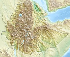
Mount Chilalo

Mount Chilalo
Chilalo
Chilalo is located in Ethiopia
Chilalo
Location in Ethiopia
Elevation 4,036 m (13,241 ft)
Location
Location Arsi Zone, Oromia Region, Ethiopia
Coordinates 7°55′N 39°16′E / 7.917°N 39.267°E / 7.917; 39.267Coordinates: 7°55′N 39°16′E / 7.917°N 39.267°E / 7.917; 39.267

Mount Chilalo is an isolated, extinct silicic volcanic mountain in southeastern Ethiopia. The highest point in the Arsi Zone of the Oromia Region, and located on the border between the Hitosa and Tiyo woreda, this mountain has a latitude and longitude of 07°55′N 39°16′E / 7.917°N 39.267°E / 7.917; 39.267 with an elevation of 4,036 metres (13,241 ft) above sea level.

The mountain has an elliptical base (about 30 by 20 kilometers), whose major axis lies NNE-SSW or parallel to the predominant tectonic trend. Chilalo rises with gentle slopes for more than 1500 meters from the top of the plateau. At the summit, there is a large, almost circular caldera about 6 kilometers in diameter, whose southern rim is considered to be the mountain's summit. Mount Chilalo last erupted in the Pleistocene.[1]

One authority identifies Mount Chilalo as a late Trap Series volcano.[2] The geologist Erik Nilsson claimed to have identified traces of glaciation on Chilalo, as well as on its neighbor Mount Kaka down to about 3400 meters, which he dated to the "Last Pluvial Period".[3] Although this mountain is located south of the Great Rift Valley, along with Mount Gugu to the north and Mount Kaka to the south, it is considered, geologically speaking, part of the Ethiopian Highlands.

Notes

  1. ^ Cilallo Volcano - John Seach, Volcano Live website (accessed 1 November 2009)
  2. ^ "Local History in Ethiopia" The Nordic Africa Institute website (accessed 19 December 2007)
  3. ^ Erik Nilsson, "Traces of Ancient Changes of Climate in East Africa: Preliminary Report", Geografiska Annaler, 17 (1935), pp. 13f

Wikimedia Foundation. 2010.

Игры ⚽ Поможем сделать НИР

Look at other dictionaries:

  • Ethiopia — /ee thee oh pee euh/, n. 1. Formerly, Abyssinia. a republic in E Africa: formerly a monarchy. 58,732,577; 409,266 sq. mi. (1,060,000 sq. km). Present boundaries include Eritrea. Cap.: Addis Ababa. 2. Also called Abyssinia. an ancient region in NE …   Universalium

  • Arsi Zone — Arsi (or Arssi) is one of the 12 zones of the Oromia Region in Ethiopia. Arsi is also the name of a former province. Both the Zone and the former province are named after a subgroup of the Oromo, who inhabit both. Arsi is bordered on the south by …   Wikipedia

  • Asela — can refer to:*Asella, a town in Ethiopia, west of Mount Chilalo. *Asella Airport, IATA airport code ALK, located in Ethiopia. *Asela, a Sinhala king of the 2nd century BC …   Wikipedia

  • Hitosa — is one of the 180 woredas in the Oromia Region of Ethiopia. Part of the Arsi Zone, Hitosa is bordered on the south by Digeluna Tijo, on the southwest by Tiyo, on the west by Ziway Dugda, on the northwest by the Misraq Shewa Zone, on the northeast …   Wikipedia

  • Tiyo (woreda) — Tiyo is one of the 180 woredas in the Oromia Region of Ethiopia. Part of the Arsi Zone, Tiyo is bordered on the south by Munesa, on the west by Ziway Dugda, on the northeast by Hitosa, and on the southeast by Digeluna Tijo. The woreda and Zonal… …   Wikipedia

  • Asela — ▪ Ethiopia also spelled  Asella, or Assela,         town, south central Ethiopia. It lies west of Mount Chilalo on a high plateau overlooking Lake Ziway in the Great Rift Valley. The town is an important trading centre for the surrounding… …   Universalium

  • Geography of Ethiopia — Map of Ethiopia. Satellite image of Ethiopi …   Wikipedia

  • Digeluna Tijo — is one of the 180 woredas in the Oromia Region of Ethiopia. Part of the Arsi Zone, Digeluna Tijo is bordered on the south by Bekoji, on the southwest by Munesa, on the northwest by Tiyo, on the north by Hitosa, on the northeast by Tena, and on… …   Wikipedia

Share the article and excerpts

Direct link
Do a right-click on the link above
and select “Copy Link”