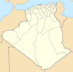
Chéraga — Country Algeria Province Algiers Time zone West Afri … Wikipedia
Dar El Beïda District — دائرة الدار البيضاء District Map of Algeria highlighting Algiers Province … Wikipedia
Draria District — دائرة درارية District Map of Algeria highlighting Algiers Province … Wikipedia
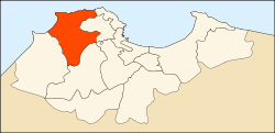
Zéralda District — Infobox Algerian District map1 = DZ 16.svg map2 = DZ 16 01.svg name1 = Chéraga name2 = زرالدة province = Algiers capital = Chéraga municipalities = 5 code = 01 chef = area1 = area2 = population = 104 151 popyear = 1998 density1 = density2… … Wikipedia
Dar El Beïda — This article is about Algerian city. For the Moroccan city, see Casablanca. Houari Boumedienne Airport Dar El Beïda (Arabic: الدار البضاء) is a suburb of Algiers, Algeria. It is the seat of the district with the same name. During … Wikipedia
Ouled Chebel — Commune and town Country Algeria Province … Wikipedia
Mohamed Belouizdad — Mohamed Belouizdad, formerly Hamma Anassers is a quarter of Algiers, Algeria in Algiers Province. Important places in Mohamed Belouizdad are: Hotel Sofitel National Library Jardin d essai Stade 20 Août 1955 Personalities Biyouna Mohammed… … Wikipedia
Dély Ibrahim — Dely Brahim Country Algeria Province Algiers Time zone West Africa Time (UTC+1) Dely Brahim is a suburb of the city of Algiers in northern Algeria. Here is located Serbian Military cemetery, created between 1916 and 1919. At the time in … Wikipedia
Douéra — Douera Country Algeria Province Algiers Time zone West Africa Time (UTC+1) Douera is a suburb of the city of Algiers in northern Algeria. Coordinates … Wikipedia
Draria — Country Algeria Province Algiers Time zone West Africa Time (UTC+1) Draria is a suburb of the city of Algiers in northern Algeria. Coordinates … Wikipedia
 Algeria


