North East Reef

North East Reef
North East Reef

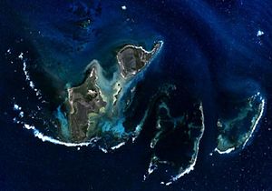
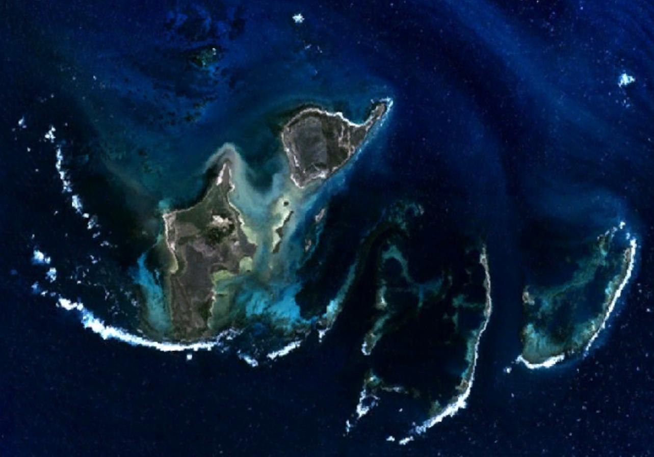
North East Reef is a reef in the Wallabi Group of the Houtman Abrolhos, in the Indian Ocean off the coast of Western Australia. Located at 28°25′13″S 113°48′41″E / 28.42028°S 113.81139°E / -28.42028; 113.81139Coordinates: 28°25′13″S 113°48′41″E / 28.42028°S 113.81139°E / -28.42028; 113.81139,[1][2] it takes its name from the fact that it is situated to the north-east of the main body of islands that makes up the Wallabi Group.[3] The island is part of the Houtman Abrolhos Important Bird Area, identified as such by BirdLife International because of its importance for supporting large numbers of breeding seabirds.[4]

References

  1. ^ Gazetteer of Australia (1996). Belconnen, ACT: Australian Surveying and Land Information Group.
  2. ^ "North East Reef". Gazetteer of Australia online. Geoscience Australia, Australian Government. http://www.ga.gov.au/bin/gazd01?rec=277046. 
  3. ^ Australia 1:100000 Topographic Survey, Map sheet 1641 (Edition 1): Wallabi
  4. ^ "IBA: Houtman Abrolhos". Birdata. Birds Australia. http://www.birdata.com.au/iba.vm. Retrieved 2011-08-12. 

Wikimedia Foundation. 2010.

Игры ⚽ Нужен реферат?

Look at other dictionaries:

  • North East Island — may refer to: North East Island National Park, Queensland, Australia North East Island, New Zealand, main island of the Snares Island group North East Isle (Tasmania), Australia North East Penang Island, Malaysia North and East Island group,… …   Wikipedia

  • North Carr — is NE of Crail, at the mouth of the Firth of Forth The North Carr Reef (also known as North Carr Shoals, Carr Briggs North Carr Rocks) is a sandstone reef northeast of Edinburgh, on the headland between the Firth of Forth and St Andrews Bay.… …   Wikipedia

  • North Direction Island — is 25 km North East of Cape Flattery in the Great Barrier Reef Marine Park Authority and about 15 km South of Lizard Island. Aerial photos maps North Direction Island is at coordinates 14°44′42″S 145°30′36″E …   Wikipedia

  • North Direction Island (Queensland) — North Direction Island is 25 km North East of Cape Flattery in the Great Barrier Reef Marine Park Authority and about 15km South of Lizard Island. Aerial photos maps …   Wikipedia

  • Reef Bay Sugar Factory Historic District — Infobox nrhp |name =Reef Bay Sugar Factory Historic District nrhp type = hd caption = Reef Bay Sugar Factory location= lat degrees = 18 lat minutes = 19 lat seconds = 30 lat direction = N long degrees = 64 long minutes = 44 long seconds = 42 long …   Wikipedia

  • East Australian Current — The East Australian Current is an ocean current that moves warm water in a counter clock wise fashion down the east coast of Australia. [http://earthobservatory.nasa.gov/NaturalHazards/shownh.php3?img id=13055 East Australian Current,] NASA Earth …   Wikipedia

  • North Island (Houtman Abrolhos) — North Island Aerial photograph of the southern half of North Island, looking west …   Wikipedia

  • North Reef Light — from the air, 2007 …   Wikipedia

  • North Halmahera Regency — North Halmahera   Regency   …   Wikipedia

  • North Brother Island Light — Location North Brother Island, New York Harbor Coordinates …   Wikipedia

Share the article and excerpts

Direct link
Do a right-click on the link above
and select “Copy Link”