- Haarlemmerliede en Spaarnwoude
Infobox Settlement
official_name = Haarlemmerliede en Spaarnwoudde
imagesize =
image_caption =
flag_size = 120x100px
image_shield = Haarlemmerliede wapen.png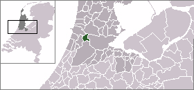
mapsize = 280px
subdivision_type = Country
subdivision_name =Netherlands
subdivision_type1 = Province
subdivision_name1 =North Holland
leader_name = E.J. van Hoogdalem-Arkema
leader_party = CDA
area_footnotes = (2006)
area_total_km2 = 21.08
area_land_km2 = 19.25
area_water_km2 = 1.84
population_as_of =1 January ,2007
population_note = Source: CBS, [http://statline.cbs.nl/ Statline] .
settlement_type = Municipality
population_total = 5441
population_density_km2 = 283
timezone = CET
utc_offset = +1
timezone_DST = CEST
utc_offset_DST = +2
latd = 52.38
latNS = N
longd = 4.75
longEW = E
website = [http://www.haarlemmerliede.nl www.haarlemmerliede.nl].
Population centres
The municipality of Haarlemmerliede en Spaarnwoude consists of the following cities, towns, villages and/or districts:
Haarlemmerliede ,Halfweg ,Penningsveer ,Spaarndam (partly),Spaarnwoude ,Vinkebrug .History
The municipality was formed on September 8, 1857, through the merger of the former municipalities of Haarlemmerliede and Spaarnwoude. Repertorium Nederlandse Gemeenten]
On September 22, 1863,
Houtrijk en Polanen andZuidschalkwijk were added to the municipality , of which Zuidschalkwijk was subsequently annexed by the city ofHaarlem .During the construction of the
North Sea Canal (completed 1867), large portions of the IJ Bay were enclosed with dikes and made intopolder s, thereby enlarging the area of the municipality significantly. On the other hand, Haarlemmerliede en Spaarnwoude lost large areas to the cities of Haarlem and Amsterdam in 1927, 1963, and 1970.Local government
The municipal council of Haarlemmerliede en Spaarnwoude consists of 11 seats, which are divided as follows:
* CDA - 4 seats
* VVD - 3 seats
* D66 - 2 seats
* PvdA - 2 seatsReferences
* Statistics are taken from the [http://www.sdu.nl/staatscourant/gemeentes/gem193nh.htm SDU Staatscourant]
External links
* [http://www.spaarnwoude.nl/images/plattegrond/spaarnwoude.jpgMap of Spaarnwoude]
Wikimedia Foundation. 2010.