- Tahuata
French commune|nomcommune=Tahuata
map_size=280px
adjustable_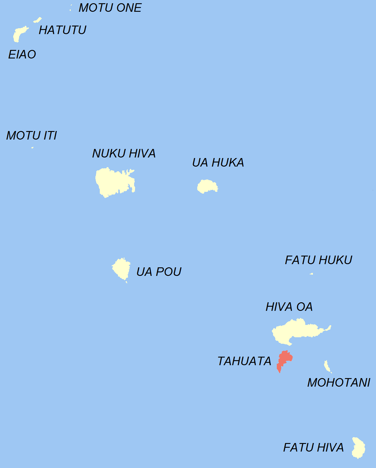
mapcaption=Location of the commune (in red) within the Marquesas Islands
overseas collectivity=French Polynesia
lat_long=
administrative subdivision=Marquesas Islands
commune centre=Vaitahu
insee=98746
cp=98743
mayor=Teaiki Félix Barsinas
|mandat=
longitude=|latitude=
alt moy=|alt mini=0 m|alt maxi=1,050 m
km²=69
sans=671
date-sans=Aug. 2007 census
dens=9.7|date-dens=2007 census|Tahuata is the smallest of the inhabited
Marquesas Islands , inFrench Polynesia , an overseas territory ofFrance in thePacific Ocean . It is located 4 km (2.5 mi.) to the south of the western end ofHiva Oa , across theCanal du Bordelais , called Ha‘ava in Marquesan.Administration
Administratively, Tahuata forms the commune (municipality) of Tahuata, part of the administrative subdivision of the
Marquesas Islands . This commune consists solely of the island of Tahuata itself.The administrative centre of the commune is the settlement of Vaitahu, on the western side of the island.
Geography
Tahuata is approx. 69 km² (26.6 sq. mi.) The highest point on the island is Mount
Amatea (French: "Mont Amatea"), rising to an elevation of 1,050 m (3,445 ft.).Demographics
The
2007 census population was 671.History
Archæological evidence indicates that Tahuata was inhabited by
Polynesians as early as 200 CE.In later pre-European times, the
tribe s of Tahuata were allied with the tribes from theNuku province of Hiva Oa, and the island was considered a dependency of that province.The first
Europe an explorers disembarked on Tahuata in1595 , beginning with the Spanishnavigator Álvaro de Mendaña de Neira at Vaitahu, followed by CaptainJames Cook in1774 and Admiral Dupetit-Thouars in1842 , who signed thetreaty annex ing theMarquesas Islands toFrance .Communications
Because there is insufficient level ground for even a small
runway , the island is served by theairport on Hiva Oa. This serves to give the island a feeling of much greater isolation, despite its proximity to Hiva Oa.ee also
*
French Polynesia
Wikimedia Foundation. 2010.