- Jomsom
Infobox Settlement
official_name = Jomsom
other_name =
native_name =
nickname =
settlement_type =
motto =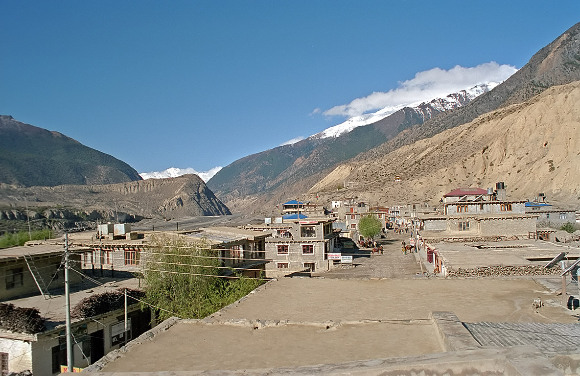
imagesize =300px
image_caption =
flag_size =
image_
seal_size =
image_shield =
shield_size =
image_blank_emblem =
blank_emblem_type =
blank_emblem_size =
mapsize =
map_caption =
mapsize1 =
map_caption1 =
image_dot_
dot_mapsize =
dot_map_caption =
dot_x = |dot_y =
pushpin_
pushpin_label_position =bottom
pushpin_mapsize =340
pushpin_map_caption =Location in Nepal
subdivision_type = Country
subdivision_name = flag|Nepal
subdivision_type1 = Zone
subdivision_name1 =Dhawalagiri Zone
subdivision_type2 = District
subdivision_name2 =Mustang District
subdivision_type3 =
subdivision_name3 =
subdivision_type4 =
subdivision_name4 =
government_footnotes =
government_type =
leader_title =
leader_name =
leader_title1 =
leader_name1 =
leader_title2 =
leader_name2 =
leader_title3 =
leader_name3 =
leader_title4 =
leader_name4 =
established_title =
established_date =
established_title2 =
established_date2 =
established_title3 =
established_date3 =
area_magnitude =
unit_pref =Imperial
area_footnotes =
area_total_km2 =
area_land_km2 =
area_water_km2 =
area_total_sq_mi =
area_land_sq_mi =
area_water_sq_mi =
area_water_percent =
area_urban_km2 =
area_urban_sq_mi =
area_metro_km2 =
area_metro_sq_mi =
area_blank1_title =
area_blank1_km2 =
area_blank1_sq_mi =
population_as_of =1991
population_footnotes =
population_note =
population_total =
population_density_km2 =
population_density_sq_mi =
population_metro =
population_density_metro_km2 =
population_density_metro_sq_mi =
population_urban =
population_density_urban_km2 =
population_density_urban_sq_mi =
population_blank1_title =Ethnicities
population_blank1 =
population_blank2_title =
population_blank2 =
population_density_blank1_km2 =
population_density_blank1_sq_mi =
timezone =Nepal Time
utc_offset = +5:45
timezone_DST =
utc_offset_DST =
latd=28 |latm=47|lats=0 |latNS=N
longd=83|longm=43|longs=50|longEW=E
elevation_footnotes =
elevation_m =
elevation_ft =
postal_code_type =
postal_code =
area_code =
blank_name =
blank_info =
blank1_name =
blank1_info =
website =
footnotes =Jomsom, also known as Dzongsam or New Fort, is a town located at an altitude of 2800m in Mustang,
Nepal . It extends over both the banks of theKali Gandaki River . Along the banks of Kali Gandaki river there are rocks holy to the Hindus. The soaring peaks ofDhaulagiri and Nilgiri form a backdrop. As the district headquarters, it is primarily an administrative and commercial center with government officials and merchants rubbing shoulders with the local residents of the region, known asThakali s. A company of the Nepalese Army is stationed here. Nearby isJomsom Airport from where there are regular flights.A trail passes through the Lower Mustang region of Nepal, ending at the village of Kagbeni, a Tibetan influenced village filled with prayer wheels, shortens and a Buddhist monastery. The trail follows the Kali Gandaki River which forms the deepest ravine in the world; on one side lies the
Annapurna mountain range and on the other side is Dhaulagiri. Between the two ranges, there are views of 8 of the 20 highest mountains in the world. The Kali Gandaki is a quarter of a mile wide river bed; during the winter the river will be dry, but during the summer and monsoon it fills with rain water and melting snow. The scenery of the trail ranges from forests of brilliant redrhododendrons to rocky cliffs and desert. The culture along the track is a rich mixture of Hindu andTibetan Buddhism . The trail's highest point isMuktinath at 3800 m, a holy site of temples sacred to both Buddhists and Hindus for centuries.

Wikimedia Foundation. 2010.