Chudeřice

Chudeřice
Chudeřice
Village
Flag
Coat of arms
Country Czech Republic
Region Hradec Králové
District Hradec Králové
Commune Hradec Králové
Municipality Chlumec nad Cidlinou
Elevation 230 m (755 ft)
Coordinates 50°8′50″N 15°32′51″E / 50.14722°N 15.5475°E / 50.14722; 15.5475
Area 2.15 km2 (0.83 sq mi)
Population 211
Density 98 / km2 (254 / sq mi)
First mentioned 1318
Mayor Miloš Veselý
Timezone CET (UTC+1)
 - summer (DST) CEST (UTC+2)
Postal code 503 51
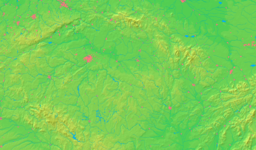
Location in the Czech Republic
Wikimedia Commons: Chudeřice
Statistics: statnisprava.cz
Website: www.chuderice.cz

Chudeřice is a village in the Czech Republic.

External links


Wikimedia Foundation. 2010.

Игры ⚽ Поможем решить контрольную работу

Look at other dictionaries:

  • Bahnstrecke Trmice–Bílina — Trmice–Bílina Kursbuchstrecke (SŽDC): 131 Streckenlänge: 25,823 km Spurweite: 1435 mm (Normalspur) Streckenklasse: D4 (2006) Stromsystem: 3 kV = Maximale Neigung …   Deutsch Wikipedia

  • List of German exonyms for places in the Czech Republic — Below are links to subpages with more detailed listings of the German language names of towns and villages in different regions of the Czech Republic. Many of these German names are now exonyms, but used to be endonyms commonly used by the local… …   Wikipedia

  • Liste deutscher Bezeichnungen tschechischer Orte — In dieser Liste werden deutschen (heute großteils nicht mehr geläufigen) topografischen Namen die tschechischen, amtlichen Pendants gegenübergestellt. Durch die Vertreibungen nach 1945 wurden viele kleinere Orte und Gehöfte, insbesondere in… …   Deutsch Wikipedia

  • District de Hradec Králové — Situation du district de Hradec Králové Le district de Hradec Králové (Okres Hradec Králové en tchèque) est un des cinq districts de la région de Hradec Králové en République tchèque. Sa capitale est la ville de Hradec Králové. Liste des… …   Wikipédia en Français

  • Chlumec nad Cidlinou — Coordinates: 50°9′20″N 15°27′28″E / 50.15556°N 15.45778°E / 50.15556; 15.45778 …   Wikipedia

  • Kratonohy — Coordinates: 50°10′N 15°36′E / 50.167°N 15.6°E / 50.167; 15.6 …   Wikipedia

  • Mokrovousy — Coordinates: 50°16′28″N 15°41′07″E / 50.27444°N 15.68528°E / 50.27444; 15.68528 …   Wikipedia

  • Nový Bydžov — Coordinates: 50°14′25″N 15°29′31″E / 50.24028°N 15.49194°E / 50.24028; 15.49194 …   Wikipedia

  • Hradec Králové District — Okres Hradec Králové   District   …   Wikipedia

  • Nechanice — Coordinates: 50°14′18″N 15°37′51″E / 50.23833°N 15.63083°E / 50.23833; 15.63083 …   Wikipedia

Share the article and excerpts

Direct link
Do a right-click on the link above
and select “Copy Link”