- Armadale Road, Perth
Infobox Australian Road
road_name = Armadale Road
route_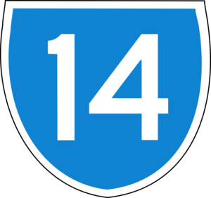
length =
direction = East-West
start =Albany Highway , Armadale
finish =Kwinana Freeway
est =
through = Armadale, Brookdale, Forrestdale, Banjup, Atwell
route = State Route 14
exits = Church Avenue, Railway Avenue, Seville Drive, Lake Road,Tonkin Highway , Nicholson Road, Warton Road, Tapper Road,Kwinana Freeway Armadale Road is a major road in the south and south east of the Perth Metropolitan Area. It connects
Armadale to theKwinana Freeway , and serves as part of a main route fromArmadale toFremantle . Since 2005 it has connectedArmadale to theTonkin Highway , a major route to Perth, thePerth Airport and the northern suburbs.Armadale goes from theAlbany Highway /South Western Highway intersection inArmadale to theKwinana Freeway inJandakot .Armadale Road follows the dismantled Fremantle-Armadale railway line.
Armadale Road only went up to Forrest Road in
Forrestdale prior to the extension of the Kwinana Freeway in the early 1990s (continuing as Forrest Road after that) as Forrest Road was a road extending fromHamilton Hill toArmadale . The realignment of Forrest Road as theKwinana Freeway was extended saw it renamed as Armadale Road up to the Freeway.It is part of the state route 14 which eastbound starts as
Beeliar Drive inYangebup , continuing as Armadale Road from the Freeway and then continues as theAlbany Highway branch fromArmadale to Albany.Major Intersections
)
)
)
)
)
peed Limits
70km/h from
Albany Highway /South Western Highway and increases to 80km/h just after the railway line. It increases to 90km/h fromNicholson Road and then goes down to 70km/h just before Tapper Road inAtwell

Wikimedia Foundation. 2010.