- St. Margarets Bay, Nova Scotia (administrative district)
Infobox Settlement
official_name = Pagename
other_name =
native_name =
nickname =
settlement_type = Community
motto =
imagesize =
image_caption =
flag_size =
image_
seal_size =
image_shield =
shield_size =
city_logo =
citylogo_size =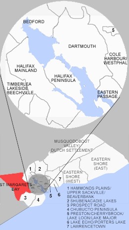
mapsize = 275px
map_caption = Location of Pagename
mapsize1 =
map_caption1 =
image_dot_
dot_mapsize = 250px
dot_map_caption =Location of Pagename
dot_x = |dot_y =
pushpin_
pushpin_label_position =
pushpin_map_caption =
pushpin_mapsize =
subdivision_type = Country
subdivision_name = CAN
subdivision_type1 = Province
subdivision_name1 = NS
subdivision_type2 = Municipality
subdivision_name2 =Halifax Regional Municipality
subdivision_type3 = Communities
subdivision_name3 = Black Point, Boutiliers Point, French Village, Glen Haven, Glen Margaret, Hacketts Cove, Head of St. Margarets Bay, Hubbards, Hubley, Indian Harbour, Ingramport, Lewis Lake, Peggys Cove, Queensland, Seabright, Simms Settlement, Tantallon, Upper Tantallon
subdivision_type4 =
subdivision_name4 =
government_footnotes =
government_type =
leader_title =Council
leader_name =Western Region Community Council
leader_title1 =
leader_name1 =
leader_title2 =
leader_name2 =
leader_title3 =
leader_name3 =
leader_title4 =
leader_name4 =
established_title = Founded
established_date = 1612 (Head of St. Margarets Bay)
established_title2 =
established_date2 =
established_title3 =
established_date3 =
area_magnitude =
unit_pref =
area_footnotes =
area_total_km2 =
area_land_km2 =
area_water_km2 =
area_total_sq_mi =
area_land_sq_mi =
area_water_sq_mi =
area_water_percent =
area_urban_km2 =
area_urban_sq_mi =
area_metro_km2 =
area_metro_sq_mi =
population_as_of = 2006
population_footnotes =
population_note =
population_total =
population_density_km2 =
population_density_sq_mi =
population_metro =
population_density_metro_km2 =
population_density_metro_sq_mi =
population_urban =
population_density_urban_km2 =
population_density_urban_sq_mi =
population_blank1_title =
population_blank1 =
population_density_blank1_km2 =
population_density_blank1_sq_mi =
timezone = AST
utc_offset = -4
timezone_DST =
utc_offset_DST =
latd= |latm= |lats= |latNS=N
longd= |longm= |longs= |longEW=W
elevation_footnotes =
elevation_m =
elevation_ft =
postal_code_type =
postal_code =
area_code = 902
blank_name =
blank_info =
blank1_name =
blank1_info =
website =
footnotes =Part of a series about Places in Nova Scotia St. Margarets Bay is a Canadian administrative district in
Nova Scotia 's Halifax Regional Municipality.It is a rural area located on the southwestern part of Halifax County comprising those communities in the county located on the eastern and northern shores of St. Margarets Bay through to the county line, terminating at the community of Hubbards.
Wikimedia Foundation. 2010.