Bare Island, New Zealand

Bare Island, New Zealand
Bare Island
Motu-O-Kura (Māori)
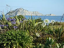
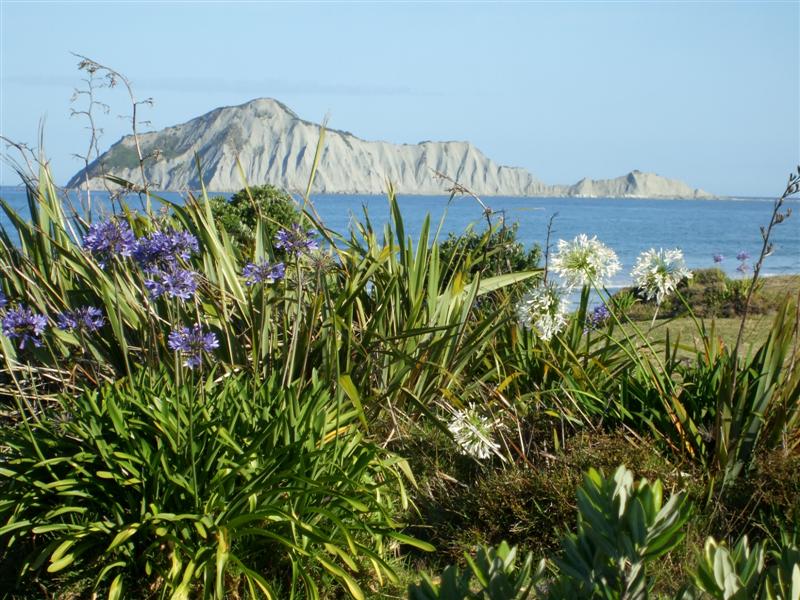
Bare Island
Geography
Location Hawke's Bay
Coordinates 39°49′59″S 177°01′39″E / 39.833125°S 177.027589°E / -39.833125; 177.027589
Area 15 ha (37 acres)
Highest elevation 106 m (348 ft)
Country
Demographics
Population 0

Bare Island, also known as Motu-O-Kura (or "the Island of Kura" in Māori), is a small island located in the Pacific Ocean in the southern Hawke's Bay on the eastern North Island of New Zealand. It is located 2 kilometres (1.2 mi) off the North island coast, near Waimarama, 25 kilometres (16 mi) south of Cape Kidnappers.

On the south-west side of the island, there is an aquifer exuding fresh water (called Nga Puhake-o-te-ora or "the burp of life"). From the shore Motuokura is bare, but from the seaward side, there is enough cover to provide resting sites for blue penguins and sooty shearwaters.

When Jules Dumont d'Urville sailed past in 1827 he reported houses and boats on the seaward side.

Contents

The legend of Motu-O-Kur1a

According to Māori legend, the island is named after a woman named Kura. Kura, during times of siege, would dive down to obtain fresh water from the aquifer on the island[1].

See also

References

External links


Wikimedia Foundation. 2010.

Игры ⚽ Поможем решить контрольную работу

Look at other dictionaries:

  • Dent Island, New Zealand — Dent Island, New Zealand. Geography Coordinates …   Wikipedia

  • Bare Island — may refer to:*Bare Island (Massachusetts) *Bare Island (New South Wales) *Bare Island, New Zealand …   Wikipedia

  • New Zealand — New Zealander. /zee leuhnd/ a country in the S Pacific, SE of Australia, consisting of North Island, South Island, and adjacent small islands: a member of the Commonwealth of Nations. 3,587,275; 103,416 sq. mi. (267,845 sq. km). Cap.: Wellington …   Universalium

  • New Zealand sea urchin — Scientific classification Kingdom: Animalia Phylum …   Wikipedia

  • New Zealand wine — Map showing major cities and approximate location of the main NZ wine growing areas New Zealand wine is largely produced in ten major wine growing regions spanning latitudes 36° to 45° South and extending 1,600 kilometres (990 mi). They are …   Wikipedia

  • Air New Zealand — IATA NZ ICAO ANZ Callsign NEW ZEALAND …   Wikipedia

  • Territorial authorities of New Zealand — Territorial authorities are the second tier of local government in New Zealand, below regional councils. There are 73 territorial authorities: 16 city councils, 56 district councils, and the Chatham Islands Council. Five territorial authorities… …   Wikipedia

  • May 2005 in Australia and New Zealand — 2005 : January February March April May June July August September October November December → NOTOC May 31, 2005 (Tuesday)* In Botswana, Australian lecturer Kenneth Good loses his appeal against deportation. He had criticized the government of… …   Wikipedia

  • Kawau Island — Kawau redirects here. For other uses see Te Kawau and Jason Kawau Kawau Island is an island in the Hauraki Gulf, close to the north eastern coast of the North Island of New Zealand. It lies 2 km off the coast of the North Auckland Peninsula, just …   Wikipedia

  • Heard Island and McDonald Islands — Heard Island Nickname: HIMI Satellite image of the southern tip of Heard Island. Cape Arkona is seen on the left side of the image, with Lied Glacier just above and Gotley Glacier just below. Big Ben Volcano and Mawson Peak are seen at the lower… …   Wikipedia

Share the article and excerpts

Direct link
Do a right-click on the link above
and select “Copy Link”