- Reusel-De Mierden
Infobox Settlement
official_name = Reusel-De Mierden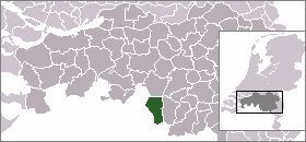
mapsize = 280px
subdivision_type = Country
subdivision_name =Netherlands
subdivision_type1 = Province
subdivision_name1 =North Brabant
area_footnotes = (2006)
area_total_km2 = 78.65
area_land_km2 = 77.93
area_water_km2 = 0.72
population_as_of =1 January ,2007
population_note = Source: CBS, [http://statline.cbs.nl/ Statline] .
settlement_type = Municipality
population_total = 12364
population_density_km2 = 159
timezone = CET
utc_offset = +1
timezone_DST = CEST
utc_offset_DST = +2Reusel-De Mierden (pronunciation|217 Reussel-De Mierden.ogg) is a
municipality in the southernNetherlands . It is located in theNorth Brabant province, and has an area of 78.65 km². In2005 , the population was approximately 12,288.Population centres
*
Hooge Mierde
*Hulsel
*Lage Mierde
*Reusel External links
* [http://www.reuseldemierden.nl Official website]
Wikimedia Foundation. 2010.