- Abcoude
Infobox Settlement
official_name = Abcoude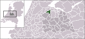
mapsize = 280px
subdivision_type = Country
subdivision_name =Netherlands
subdivision_type1 = Province
subdivision_name1 = Utrecht
leader_name = J. Streng
leader_party = VVD
area_footnotes = (2006)
area_total_km2 = 32.11
area_land_km2 = 30.39
area_water_km2 = 1.72
population_as_of = 1 January 2007
population_note = Source: CBS, [http://statline.cbs.nl/ Statline] .
settlement_type = Municipality
population_total = 8657
population_density_km2 = 285
timezone = CET
utc_offset = +1
timezone_DST = CEST
utc_offset_DST = +2
latd = 52.27
latNS = N
longd = 4.97
longEW = E
website = [http://www.abcoude.nl www.abcoude.nl].
Population centres
The municipality of Abcoude consists of the villages Abcoude and
Baambrugge , and the hamletStokkelaarsbrug .The village Abcoude
The village of Abcoude is the main town of the municipality. It lies about 13 km southeast of (the centre of)
Amsterdam , on the confluence of theAngstel River ,Gein River andHolendrecht River .In 2001, the town of Abcoude had 6431 inhabitants. The built-up area of the town was 1.28 km², and contained 2678 residences. The current approximation is over 8000.Statistics Netherlands (CBS), "Bevolkingskernen in Nederland 2001" [http://www.cbs.nl/nl-NL/menu/themas/milieu-natuur-ruimte/ruimte/publicaties/cartografie-geografie/geografische-data/2001-bevolkingskernen-in-nederland.htm] . Statistics are for the continuous built-up area.]
History
In 1672 most of the town was burned down by the French.In 1820 Abcoude had 1100 inhabitants.
The municipality of Abcoude was formed in 1941, from the former municipalities of
Abcoude-Proosdij (containing the village of Abcoude) andAbcoude-Baambrugge (containing the village of Baambrugge).Local government
The municipal council of Abcoude consists of 13 seats, which are divided as follows:
* SVAB (local party) - 3 seats
* VVD - 3 seats
* CDA - 3 seats
* PvdA - 2 seats
* D66 - 1 seat
*GroenLinks - 1 seatReferences
* Statistics are taken from the [http://www.sdu.nl/staatscourant/gemeentes/gem4u.htm SDU Staatscourant]
External links
* [http://www.plattegronden.nl/gemeenteabcoude/ A map of Abcoude]
* [http://www.abcoude.nl Official website (in Dutch)]
* [http://www.abcoude.com Unofficial website]
* [http://2miljoen.nl/Top/Nederland/Utrecht/Abcoude/ Businesses in Abcoude (in Dutch)]
Wikimedia Foundation. 2010.