Maasbree

Maasbree

Infobox Settlement
official_name = Maasbree


mapsize = 280px
subdivision_type = Country
subdivision_name = Netherlands
subdivision_type1 = Province
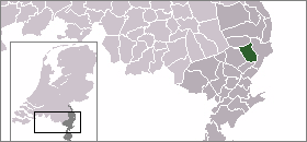
subdivision_name1 = Limburg
area_footnotes = (2006)
area_total_km2 = 49.93
area_land_km2 = 49.48
area_water_km2 = 0.45
population_as_of = 1 January, 2007
population_note = Source: CBS, [http://statline.cbs.nl/ Statline] .
settlement_type = Municipality
population_total = 12834
population_density_km2 = 259
timezone = CET
utc_offset = +1
timezone_DST = CEST
utc_offset_DST = +2

Maasbree (Pronunciation|144 Maasbree.ogg) is a municipality and a town in southeastern Netherlands. Until 1818, the municipality was just called "Bree". [Repertorium Nederlandse Gemeenten]

Population centres

*Baarlo
*Maasbree

History

In the Middle Ages Maasbree and Baarlo belonged to the duchy of Guelders. Around 1702, at the time of the War of the Spanish Succession Maasbree was occupied by Prussia and remained Prussian until 1814. In 1815 Maasbree became part of the United Kingdom of the Netherlands.

Maasbree used to be a fiefdom with a castle called "Huis Bree", which has meanwhile disappeared.

External links

* [http://www.maasbree.nl/ Official website]

References


Wikimedia Foundation. 2010.

Игры ⚽ Поможем написать курсовую

Look at other dictionaries:

  • Maasbree — Administration Pays  Pays Bas Province Limbourg néerlandais Commune …   Wikipédia en Français

  • Maasbree — Gemeinde Maasbree Flagge Wappen Provinz Limburg Bürgerm …   Deutsch Wikipedia

  • Maasbree — Original name in latin Maasbree Name in other language State code NL Continent/City Europe/Amsterdam longitude 51.3575 latitude 6.04861 altitude 31 Population 12835 Date 2010 09 17 …   Cities with a population over 1000 database

  • Maasbree — Sp Mãsbrė Ap Maasbree L Nyderlandai …   Pasaulio vietovardžiai. Internetinė duomenų bazė

  • Maasbree — Sp Mãsbrė Ap Maasbree L Olandija …   Pasaulio vietovardžiai. Internetinė duomenų bazė

  • Bong (Maasbree) — Bong is a hamlet in the Dutch province of Limburg. It is located in the municipality of Maasbree VUGA s Alfabetische Plaatsnamengids van Nederland (13th edition), VUGA, 1997.] , about 1 km west of Baarlo. ANWB Topografische Atlas Nederland ,… …   Wikipedia

  • Adelgundis — Infobox Name: Aldegundis Namenstag: 30. Januar Geburtstag: um 630 Geburtsort: Cousolre Todestag: 30.01.684 Todesort …   Deutsch Wikipedia

  • Aldegundis von Maubeuge — Infobox Name: Aldegundis Namenstag: 30. Januar Geburtstag: um 630 Geburtsort: Cousolre Todestag: 30.01.684 Todesort …   Deutsch Wikipedia

  • Blerick — (Limburgisch: Blierik) ist der links der Maas gelegene Stadtbezirk der Stadt Venlo. Blerick liegt genau zwischen den Autobahnen A67 und der A73. Der Stadtteil zählt 27.330 Einwohner (Stand: 1. Januar 2007). Damit ist Blerick nach der… …   Deutsch Wikipedia

  • Coriovallum — Gemeinde Heerlen Flagge Wappen Provinz Limburg …   Deutsch Wikipedia

Share the article and excerpts

Direct link
Do a right-click on the link above
and select “Copy Link”