- Rijssen-Holten
Infobox Settlement
official_name = Rijssen-Holten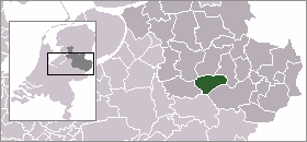
mapsize = 280px
subdivision_type = Country
subdivision_name =Netherlands
subdivision_type1 = Province
subdivision_name1 =Overijssel
area_footnotes = (2006)
area_total_km2 = 94.40
area_land_km2 = 94.18
area_water_km2 = 0.22
population_as_of =1 January ,2007
population_note = Source: CBS, [http://statline.cbs.nl/ Statline] .
settlement_type = Municipality
population_total = 36577
population_density_km2 = 388
timezone = CET
utc_offset = +1
timezone_DST = CEST
utc_offset_DST = +2, the result of a merger in 2001, after 2003 the working title Rijssen was replaced by the new name Rijssen-Holten.
Population centres
Beuseberg, De Borkeld, Dijkerhoek (2 km west of Holten), Espelo,
Holten , Holterberg, Holterbroek, Lichtenberg, Look, Neerdorp (actually a part of the village Holten) andRijssen . Only Holten and Rijssen have more than 500 inhabitants.Both Holten and Rijssen are easily accessible by car; the A1 motorway (Amsterdam -Berlin ) is only a few kilometres away. The distance between Amsterdam and Holten is about 110 km (70 miles). Rijssen lies 7 km (4,5 miles) more to the east.External links
* [http://www.rijssen-holten.nl Official website] (Dutch)
* [http://www.vvvholten.nl website of the Holten Tourist Office] ( Dutch, German)
* [http://www.vvvrijssen.nl website of the Rijssen Tourist Office] ( Dutch, German)
Wikimedia Foundation. 2010.