- Port Rickaby, South Australia
Infobox Australian Place | type = town
name = Port Rickaby
state = sa
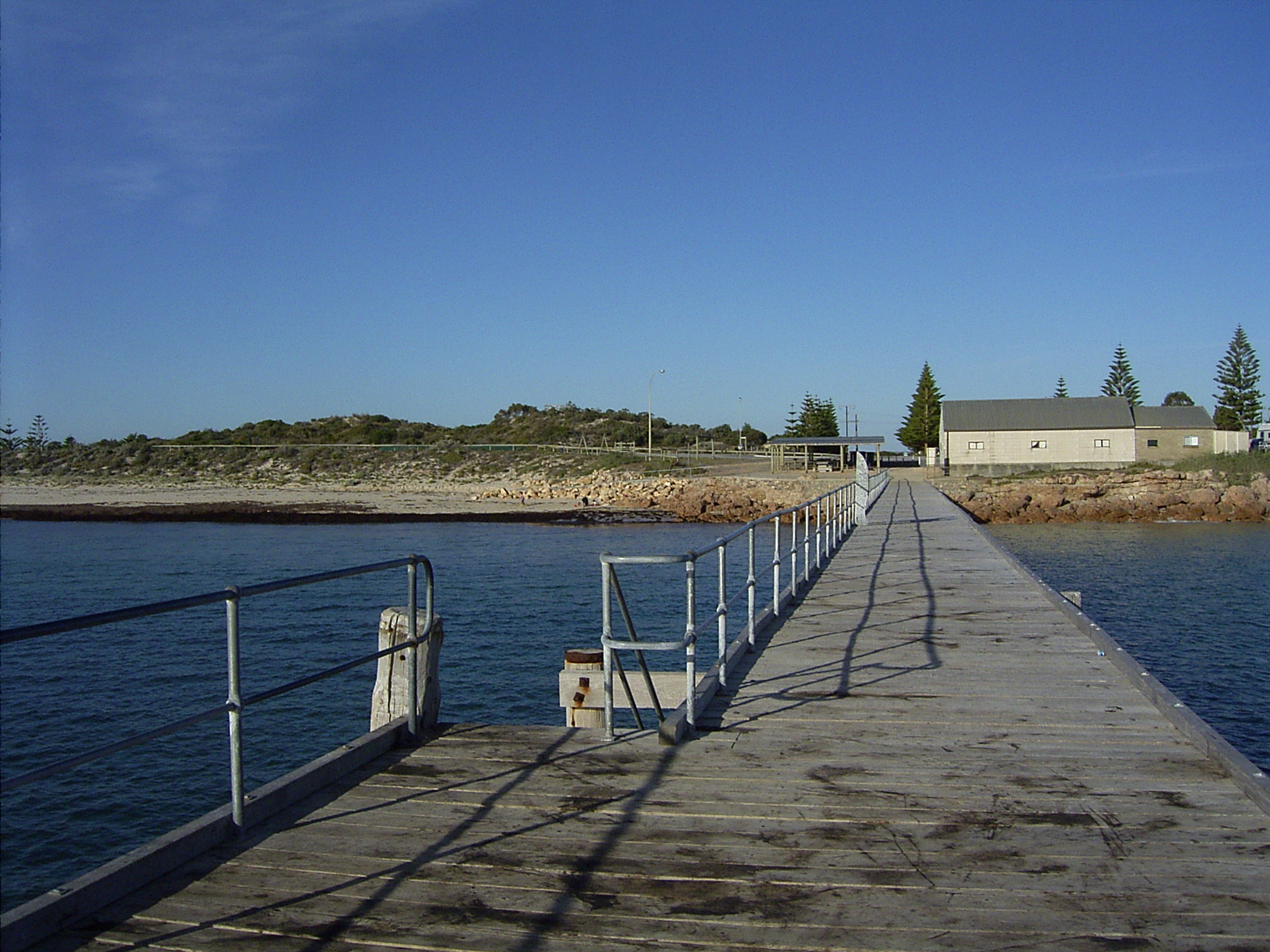
caption = Port Rickaby jetty.
lga = District Council of Yorke Peninsula
postcode = 5576
est =
pop =
elevation=
maxtemp =
mintemp =
rainfall =
stategov = Goyder
fedgov = Grey
dist1 =
dir1 =
location1=Port Ricaby is a coastal town on the
Yorke Peninsula inSouth Australia .Port Rickaby is in the
District Council of Yorke Peninsula , the stateelectoral district of Goyder and federalDivision of Wakefield .History
In 1876 the port was established as a shipping place and named after Thomas Rickaby, an early pioneer from
Ireland . Thomas arrived in South Australia in 1858, joining the South Australian Mounted policy before resigning and settling on Yorke peninsula, and was the first president of the Minlanton Agricultural show. [ [http://www.yorke.sa.gov.au/history/towns/portrickaby.html District Council of Yorke Peninsula - History and Heritage - Town By Town ] ]The greater area served by the point is known as Koolywurtie, which has an Aboriginal translation of "Where rocks meet the sea".
In 1879 a jetty was constructed to a length of 405 feet at a cost of 1285 pounds. It was lengthened three times to a total length of 820 ft in 1949.
The farmland served by the port was approximately 34000 acres. Bagged grain was brought in horse drawn wagons, and later by motor truck to be weighed and stacked in large mouse-proof sheds and yards.
Much of the grain loaded into ketches, such as the Faile, Waimana, Coringle and Eva Lita was trasferred into "WindJammers" with names such as the Passat, Kobenhaven and Pamir which were anchored off Pt.Victoria. These ships then made the overseas voyage via Cape horn to Europe. The last windjammer to leave was the the Passat which departed on 2nd of June 1949. The last Windjammer to visit these waters was the five masted "Kobenhaven" in 1924 carrying 65000 bags of wheat (7091 tonnes) Historical Marker/information sign in Port Rickaby]
The jetty was also used for the unloading of fencing materials, cement, stock, cornsacks, and all the necessary items needed for a new settlement.
In 1964 the government of the day shortened the jetty to save on repair costs.
References
External links
Wikimedia Foundation. 2010.