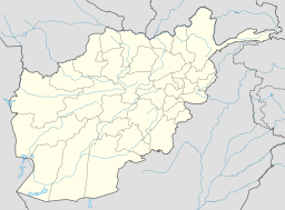
- Shebartoo
-
Shebartoo (شیبرتو/شبرتو , Dasht-e Shebartu) Plain Country Afghanistan Province Bamiyan Province District Shahidan (Shaidan) district Coordinates 34°46′52″N 67°29′25″E / 34.781111°N 67.490278°E Shebartoo (also Shibartu, Shibartoo, Shibarto, Sebartoo, Shebarto, Shebartu, Sebartu, Sibartoo), (Dari/Hazaragi language: شیبرتو/شبرتو, Dasht-e Shebartu) is a plain in Shahidan (Shaidan) district, west of Bamiyan city, the provincial capital of Bamiyan Province. The Shebartoo lies on the Bamiyan — Band-e Amir — Yakawlang road, about half-way between the Bamiyan valley and the Band-e Amir lakes.
The seven villages located on the Shebartoo are:-
- Pirdad : پیرداد
- Habashi : حبشی
- Eikhtiyaran : اختیاران
- Kaj : کج
- Goombazi :گومبزی
- Sarma Ghol : سرما قول
- Bum-e Shibar : بوم شیبر
Contents
Population
The people who live on the Shebartoo are known as the Shebartoo Hazara.
Airport
The gravel strip known as Shebartoo Airport, which is also called Bamiyan Airport (ICAO: OABN; IATA: BIN)[1], is the main airport for Bamiyan Province.[2][3]
Notes
- ^ "Bamyan BIN OABN Flight & Airport Guide" Airport Fact, accessed 26 November 2008
- ^ (29 May 1999) "Opp welcomes AI report on Taliban atrocities" Afghan News Center
- ^ Toubekis, Georgios (29 June 2007) "19th Day" Bamiyan Development Community Portal
Further reading
- Weber, Olivier (2006) "Chapitre 52: Vallon de Shebartu" Le grand festin de l'Orient ("Chapter 52: Shebartu Valley" The Great Feast of the East) R. Laffont, Paris, ISBN 2-266-14997-0, in French; an earlier edition by the same publisher was published in 2004, ISBN 2-221-09802-1
Categories:- Bamyan Province
- Hazara tribes
- Bamyan Province geography stubs
-
Wikimedia Foundation. 2010.

