- Oettersdorf
-
Oettersdorf 
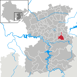
 OettersdorfLocation of Oettersdorf within Saale-Orla-Kreis district
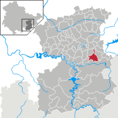
Coordinates 50°36′0″N 11°49′0″E / 50.6°N 11.816667°ECoordinates: 50°36′0″N 11°49′0″E / 50.6°N 11.816667°E Administration Country Germany State Thuringia District Saale-Orla-Kreis Municipal assoc. Seenplatte Mayor Henry Carl (SPD) Basic statistics Area 10.29 km2 (3.97 sq mi) Elevation 470 m (1542 ft) Population 850 (31 December 2010)[1] - Density 83 /km2 (214 /sq mi) Other information Time zone CET/CEST (UTC+1/+2) Licence plate SOK Postal code 07907 Area code 03663 Website www.oettersdorf.de Oettersdorf is a municipality in the district Saale-Orla-Kreis, in Thuringia, Germany.
Bad Lobenstein • Birkenhügel • Blankenberg • Blankenstein • Bodelwitz • Bucha • Burgk • Chursdorf • Crispendorf • Dittersdorf • Döbritz • Dreba • Dreitzsch • Eßbach • Gefell • Geroda • Gertewitz • Görkwitz • Göschitz • Gössitz • Grobengereuth • Harra • Hirschberg • Keila • Kirschkau • Knau • Kospoda • Krölpa • Langenorla • Lausnitz • Lemnitz • Linda bei Neustadt an der Orla • Löhma • Miesitz • Mittelpöllnitz • Moßbach • Moxa • Neundorf bei Lobenstein • Neundorf bei Schleiz • Neustadt an der Orla • Nimritz • Oberoppurg • Oettersdorf • Oppurg • Paska • Peuschen • Pillingsdorf • Plothen • Pörmitz • Pößneck • Pottiga • Quaschwitz • Ranis • Remptendorf • Rosendorf • Saalburg-Ebersdorf • Schlegel • Schleiz • Schmieritz • Schmorda • Schöndorf • Seisla • Solkwitz • Stanau • Tanna • Tegau • Tömmelsdorf • Triptis • Volkmannsdorf • Weira • Wernburg • Wilhelmsdorf • Wurzbach • Ziegenrück
References
- ^ "Bevölkerung nach Gemeinden, erfüllenden Gemeinden und Verwaltungsgemeinschaften" (in German). Thüringer Landesamt für Statistik. 31 December 2010. http://www.statistik.thueringen.de/datenbank/TabAnzeige.asp?tabelle=gg000102%7C%7C.
Categories:- Municipalities in Thuringia
- Saale-Orla-Kreis geography stubs

Wikimedia Foundation. 2010.