Mormon Flat Dam

Mormon Flat Dam
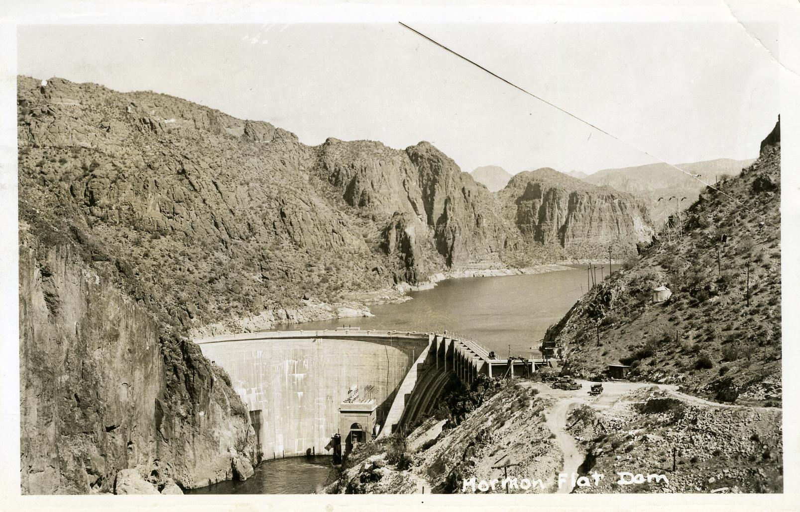
Mormon Flat Dam c. 1935

The Mormon Flat Dam is a dam on the Salt River located Northeast of Phoenix, Arizona. The dam is 380 feet long, 224 feet high and was built between 1923-25. The Dam is named after nearby Mormon Flat, a place where LDS settlers from Utah stopped to camp. There are two hydroelectric generating units in the dam; rated at 10,000 and 50,000 kW. The dam forms the Canyon Lake as it slows the passage of the Salt River.

External links

Media related to Mormon Flat Dam at Wikimedia Commons

Coordinates: 33°33′15″N 111°26′33″W / 33.55417°N 111.4425°W / 33.55417; -111.4425


Wikimedia Foundation. 2010.

Игры ⚽ Нужно решить контрольную?

Look at other dictionaries:

  • Mormon Flat Dam — Sp Mormònų Lygumõs ùžtvanka Ap Mormon Flat Dam L JAV (Arizona) …   Pasaulio vietovardžiai. Internetinė duomenų bazė

  • Salt River Project — Infobox Company company name = SRP company company type = Public and Government owned foundation = 1903 location = flagicon|USA Phoenix, Arizona, USA industry = Public utility products = Electricity Water revenue = profit US$2.5 Billion… …   Wikipedia

  • List of dams and reservoirs in the United States — This list is incomplete; you can help by expanding it. The following is a partial list of dams and reservoirs in the United States. There are an estimated 75,000 dams in the United States, impounding 600,000 mi (970,000 km) of river or about 17%… …   Wikipedia

  • Canyon Lake (Arizona) — Canyon Lake Der Canyon Lake vom Wasser aus Geographische Lage Arizona, USA Zuflüsse …   Deutsch Wikipedia

  • Salt River (Arizona) — Infobox River river name = Salt River caption = The Salt River, a tributary of the Gila, is shown highlighted on a map of the United States and Mexico origin = Gila County, Arizona mouth = Gila River near Avondale, Arizona length = elevation =… …   Wikipedia

  • Canyon Lake (Arizona) — Infobox lake lake name =Canyon Lake image lake = CanyonLake.jpg caption lake = View from the Boulder Canyon Trail image bathymetry = caption bathymetry = location = Maricopa County, Arizona coords = coord|33|32|37|N|111|26|12|W|region:US AR… …   Wikipedia

  • Salt River (Gila River) — Salt River Der Salt Lake in ArizonaVorlage:Infobox Fluss/KARTE fehlt DatenVorlage:Infobox Fluss/GKZ fehlt …   Deutsch Wikipedia

  • Mormonų Lygumos užtvanka — Sp Mormònų Lygumõs ùžtvanka Ap Mormon Flat Dam L JAV (Arizona) …   Pasaulio vietovardžiai. Internetinė duomenų bazė

  • National Register of Historic Places listings in Maricopa County, Arizona — Location of Maricopa County in Arizona This is a list of the National Register of Historic Places listings in Maricopa County, Arizona. It is intended to be a complete list of the properties and districts on the National Register of Historic… …   Wikipedia

  • Porterville, Utah — Porterville   Unincorporated community   Porterville Church in 2009 …   Wikipedia

Share the article and excerpts

Direct link
Do a right-click on the link above
and select “Copy Link”