- Brussels-Charleroi Canal
The Brussels-Charleroi Canal, also known as the Charleroi Canal amongst other similar names, ( _fr. canal Bruxelles-Charleroi, canal Charleroi or others) is an important
canal inBelgium . The canal is quite large, with a Class IV Freycinet gauge, and itsWallonia n portion is convert|47.9|km|mi|1 long. It runs fromCharleroi in the south toBrussels in the north. It is part of a north-south axis of water transport in Belgium, whereby the north ofFrance (via the Canal du Centre) includingLille andDunkirk and important waterways in the south of Belgium including theSambre valley andsillon industriel are linked to the port ofAntwerp in the north, via theBrussels-Scheldt Maritime Canal .The
Ronquières inclined plane is the most remarkable feature of the canal.History
Early proposals
The idea of a waterway to serve the cities of
Hainaut , linking them ultimately with Antwerp, was first put forward during the reign ofPhilip the Good ,Duke of Burgundy (1396-1467). In 1436, an edict authorized the modification and deepening of theSenne River, though the project turned out to be more expensive than previously thought. The city ofMechelen , the sole city allowed to tax water transport on the Senne, protested extensively at the prospect of the construction of a parallel canal, and the project was abandoned.During the 16th century, the prospect of a canal was renewed. In 1531, Charles V authorized the construction of a canal linking Charleroi and
Willebroek , though work did not begin immediately. It was not until 1550 thatMary of Habsburg , Governor of the Netherlands, finally ordered work to begin. When work was finished in 1561, the canal linked Brussels to the Scheldt at Willebroek, though it did not continue south past Brussels.As part of
France from 1795 to 1815, proposals to build the canal were hampered byNapoleon 's focus on waging expansionist wars.Work begins
During the
industrial revolution ,coal saw a tremendous rise in economic importance. The Sambre and Marne valleys are quite rich in coal, and during the reign ofWilliam I of the Netherlands (1813-1840), concrete plans to extend the canal were at last made.The project was undertaken by A.J. Barthélemy, member of the lower chamber of the
States-General of the Netherlands and adviser to theregent in Brussels. He proposed inclined planes be used instead of locks, but his idea was ahead of its time. An inclined plane is quicker, and wastes less water, than a flight of canal locks, but is more costly to install and run.Jean-François Gendebien , a very prominent Belgian politician (although Belgium was then called theSouthern Netherlands and was not independent) supported the idea, though finances had the last say in the matter, resulting in locks being chosen over inclined planes.Today's canal is actually the fourth version. The first version, built from 1827 to 1832, was a gauge of only convert|70|t|L/T S/T|lk=on. Already by 1854, work began to create a "large gauge" (today's medium gauge) of convert|300|t|L/T S/T|abbr=on on certain sections, which was done in 1857. Ambitious enlargements began again with the lock at Flanders' Gate (Porte de Flandre) in Brussels, which was expanded to a gauge of 600–800 t (590–790 L/T/660–880 S/T).
By 1933, all locks downstream of
Clabecq were modified to a capacity of convert|1350|t|L/T S/T. The last major improvement to the canal was the addition of the Class IV, 1350 tonne inclined plane at Ronquières, just uphill of Lock #5 atIttre . The inclined plane is considered a masterpiece ofcivil engineering , while the lock has a rise of convert|13.5|m|ft|0|abbr=on, one of the highest in Belgium. cite web | title = fr Plan incliné de Ronquières | url = http://www.ronquieres.be/ | publisher = Association pour la Gestion et l'Exploitation touristiques et sportives des Voies d'Eau du Hainaut | date = September 25 2007 | accessdate = October 5 | accessyear = 2007]Recent history
On
December 17 ,2005 , the body of formerRwanda n cabinet ministerJuvénal Uwilingiyimana was found in the canal. He had gone missing onNovember 21 that year, and when his body was found, it was naked and badly decomposed. Uwilingiyimana had beenindicted by theInternational Criminal Tribunal for Rwanda for his participation in the 1994Rwandan genocide . He had been meeting with ICTR officials, and many thought he was to testify against high-ranking officials from the formerHutu regime.cite web | title = Canal body 'was Rwandan minister' | url = http://news.bbc.co.uk/2/hi/africa/4554160.stm | publisher =BBC News | date = 2005-12-23 | accessdate = October 5 | accessyear = 2007]Ronquières inclined plane
The Ronquières Inclined Plane has a length of convert|1432|m|yd|0|abbr=on and lifts boats through convert|68|m|ft|0|abbr=on vertically. It consists of two large caissons mounted on rails. Each caisson measures convert|91|m|ft|0|abbr=on long by convert|12|m|ft|0|abbr=on wide and has a water depth between 3 and 3.70 m (10-12 ft). It can carry one boat of 1,350 tonnes or many smaller boats within the same limits.
Each caisson is pulled by eight cables wound by a winch with a capacity of convert|5200|t|L/T S/TFact|date=June 2008. This permits each caisson to be moved independently of the other. They can be moved between the two canal levels at a speed of convert|1.3|m/s|ft/s|0|abbr=on, boats taking 50 minutes in total to pass through the entire structure.cite web | title = The inclined plane of Ronquières | url = http://services-techniques.met.wallonie.be/en/waterways/the_inclined_plane_of_ron/ | publisher = Direction générale des services techniques [of Wallonia] | accessdate = October 6 | accessyear = 2007]
The inclined plane, while still in use, is now being promoted as a tourist site.
Traffic
* 1987 - Tonnage: 1 094 000 T - 3084
Barge s
* 1990 - Tonnage: 1 289 000 T - 3346 Barges
* 2000 - Tonnage: 2 100 000 T - 3471 Barges
* 2004 - Tonnage: 3 160 000 T - 5155 Barges
* 2005 - Tonnage: 3 019 000 T - 4812 Barges
* 2006 - Tonnage: 3 143 000 T - 5215 BargesPhoto gallery
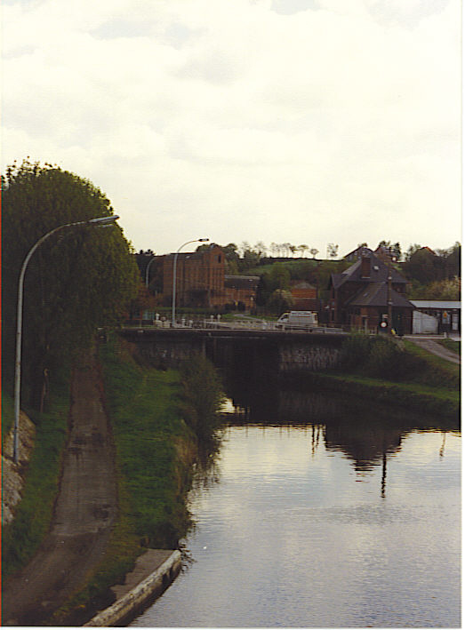
The_River_Samme,_channelled_at_Ronquières 
Ronquières inclined plane .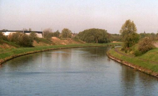
The_canal_at_Luttre References
fr Sterling, A., Dambrain, M.: "Le Canal de Charleroi à Bruxelles, témoin d'une tradition industrielle". Editions MET, 2001.
Wikimedia Foundation. 2010.