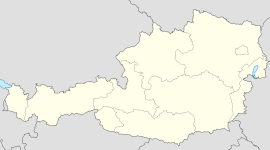
- Nesselwängle
-
Coordinates: 47°29′00″N 10°37′00″E / 47.4833333°N 10.6166667°E
Nesselwängle Country Austria State Tyrol District Reutte Mayor Richard Posch Area 23.02 km2 (9 sq mi) Elevation 1,136 m (3727 ft) Population 420 (1 January 2011)[1] - Density 18 /km² (47 /sq mi) Time zone CET/CEST (UTC+1/+2) Licence plate RE Postal code 6672 Area code 05675 Nesselwängle is a municipality in the Austrian district of Reutte, Tyrol.
References
External links
- Official website (German)
- Website of the skiing area Nesselwängle (German)
Bach · Berwang · Biberwier · Bichlbach · Breitenwang · Ehenbichl · Ehrwald · Elbigenalp · Elmen · Forchach · Gramais · Grän · Häselgehr · Heiterwang · Hinterhornbach · Höfen · Holzgau · Jungholz · Kaisers · Lechaschau · Lermoos · Musau · Namlos · Nesselwängle · Pfafflar · Pflach · Pinswang · Reutte · Schattwald · Stanzach · Steeg · Tannheim · Vils · Vorderhornbach · Wängle · Weißenbach am Lech · Zöblen
Categories:- Cities and towns in Tyrol
- Tyrol geography stubs
Wikimedia Foundation. 2010.


