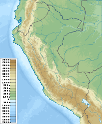
- Nevado de Huaytapallana
-
Nevado de Huaytapallana Peru Elevation 5,557 m (18,232 ft) Listing List of mountains in the Andes Location Range Andes Coordinates 11°35′11″S 74°49′15″W / 11.58639°S 74.82083°WCoordinates: 11°35′11″S 74°49′15″W / 11.58639°S 74.82083°W Climbing Easiest route Road Nevado de Huaytapallana is a peak of the Andean mountain range of Peru. Its name comes from the Quechuan term "huayta", which means flower, and “pallar”, which means to gather. Therefore, Huaytapallana means "place where the flowers take shelter" or "place where the flowers gather".
The Nevado de Huaytapallana's highest peak has an altitude at its tip of 5,557 m (18,232 ft). The second highest tip, the Yanahucsha, measures at 5,530 m (18,143 ft). The surface area of the zone is 378'40 km².
The zone contains five lagoons: Chuspicocha, Lazuhuntay, Azulcocha, Carhuacocha and Cochagrande.
Accessibility
The mountain range of the Huaytapallana is about 2 hours drive from the city of Huancayo, in the Junín Region. It is located 8 hours north-east of Lima.
For mountaineers in the mountain range, the departure point is called Virgen de las Nieves (Virgin of the Snow), located at 4,800 m (15,750 ft). At the Virgen de las Nieves there are two itineraries after which the ascent to the tip of the Nevado de Huaytapallana can be completed.
External links
Categories:- Mountains of Peru
- Junín Region
Wikimedia Foundation. 2010.

