- Kassala
Infobox Settlement
official_name = Kassala
other_name =
native_name =
nickname =
settlement_type =
motto =
imagesize = 300px
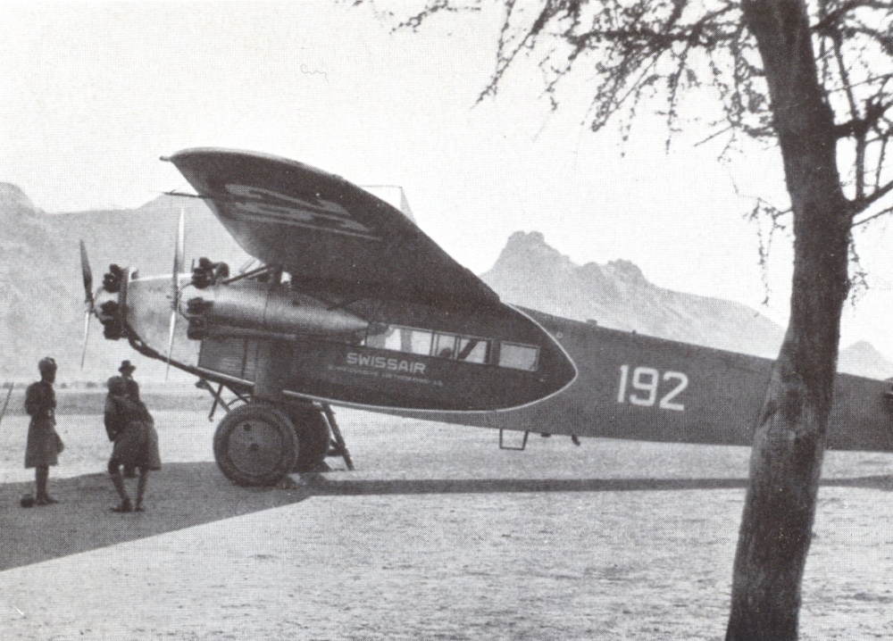
image_caption = Germans in Kassala February 1934
flag_size =
image_
seal_size =
image_shield =
shield_size =
image_blank_emblem =
blank_emblem_type =
blank_emblem_size =
mapsize =
map_caption =
mapsize1 =
map_caption1 =
image_dot_
dot_mapsize =
dot_map_caption =
dot_x = |dot_y =
pushpin_
pushpin_label_position =left
pushpin_map_caption =Location in Sudan
subdivision_type = Country
subdivision_name =
subdivision_type1 = State
subdivision_name1 =Kassala State
subdivision_type2 =
subdivision_name2 =
subdivision_type3 =
subdivision_name3 =
subdivision_type4 =
subdivision_name4 =
government_footnotes =
government_type =
leader_title =
leader_name =
leader_title1 =
leader_name1 =
leader_title2 =
leader_name2 =
leader_title3 =
leader_name3 =
leader_title4 =
leader_name4 =
established_title =
established_date =
established_title2 =
established_date2 =
established_title3 =
established_date3 =
area_magnitude =
unit_pref =Imperial
area_footnotes =
area_total_km2 =
area_land_km2 =
area_water_km2 =
area_total_sq_mi =
area_land_sq_mi =
area_water_sq_mi =
area_water_percent =
area_urban_km2 =
area_urban_sq_mi =
area_metro_km2 =
area_metro_sq_mi =
area_blank1_title =
area_blank1_km2 =
area_blank1_sq_mi =
population_as_of =1993
population_footnotes =
population_note =
population_total =234,622
population_density_km2 =
population_density_sq_mi =
population_metro =
population_density_metro_km2 =
population_density_metro_sq_mi =
population_urban =
population_density_urban_km2 =
population_density_urban_sq_mi =
population_blank1_title =Ethnicities
population_blank1 =
population_blank2_title =Religions
population_blank2 =
population_density_blank1_km2 =
population_density_blank1_sq_mi =
timezone =
utc_offset =
timezone_DST =
utc_offset_DST =
latd=15|latm=27|lats= |latNS=N
longd=36 |longm=24 |longs= |longEW=E
elevation_footnotes =
elevation_m =
elevation_ft =
postal_code_type =
postal_code =
area_code =
blank_name =
blank_info =
blank1_name =
blank1_info =
website =
footnotes =Kassala is the capital of the state of Kassala in northeastern
Sudan . Its 1993 population was recorded to be 234,622.cite web | url = http://www.geohive.com/cntry/sudan.aspx?sub=y&diacrit=1 | accessdate = 2007-02-08 | archiveurl = http://www.webcitation.org/5MUee2AgM | archivedate = 2007-02-08 | title = GeoHive] It is a railroad hub, market town and famous for its fruit gardens. Kassala's location along the mainKhartoum -Port Sudan highway makes it an important trade center.History
The city was originally created as a military camp for the Ottoman soldiers of
Egypt ianviceroy Muhammad Ali in 1840 during his military offensive into Sudan. Kassala was subsequently captured by theMahdist s in 1885, and again by the Italians in 1894. After Italy returned it in 1897, it fell under the purview ofAnglo-Egyptian Sudan until Sudanese independence.Since the 1960s, the city has been the destination of large numbers of
Ethiopia n andEritrea n refugees fleeing conflict and war. Since the beginning of theSecond Sudanese Civil War in the 1980s, it has also been refuge of internally displaced Sudanese fleeing conflicts in theNuba Mountains , and south and west of the country. About 160,000 of these IDPs settled on the outskirts of the town.Fact|date=February 2007Current status
The Kassala region now has a child mortality rate twice that of the
Darfur regionFact|date=February 2007. UN staff are not allowed into the areaFact|date=February 2007.References
* [http://www.fallingrain.com/world/SU/31/Kasala.html FallingRain Map - elevation = 531m (Red dots are railways)]
See also
*
2007 Sudan floods
*Railway stations in Sudan External links
* [http://www.ockenden.org.uk/index.asp?id=802 Kassala program] , Ockenden International
Wikimedia Foundation. 2010.

