- Portomarín
-
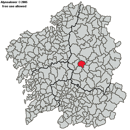
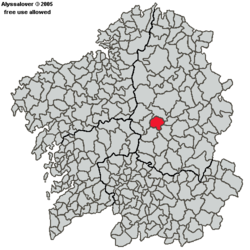 Location of Portomarín in Galicia.
Portomarín is a municipality in the Spanish province of Lugo. It has a population of 2008 (Spanish 2001 Census) and an area of 115 km². It is part of El camino francés de Santiago.
New village
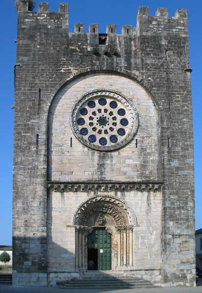
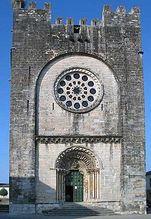 Church moved brick-by-brick
In the 1960s the Miño River was dammed to create the Belesar reservoir, putting the old village of Portomarín under water. The most historic buildings of the town were moved brick by brick and reconstructed in the new town, including its castle-style main church: Church of San Juan of Portomarín.
Municipalities in the province of Lugo Abadín · Alfoz · Antas de Ulla · Baleira · Baralla · Barreiros · Becerreá · Begonte · Bóveda · Burela · Carballedo · Castro de Rei · Castroverde · Cervantes · Cervo · Chantada · O Corgo · Cospeito · Folgoso do Courel · A Fonsagrada · Foz · Friol · Guitiriz · Guntín · O Incio · Láncara · Lourenzá · Lugo · Meira · Mondoñedo · Monforte de Lemos · Monterroso · Muras · Navia de Suarna · Negueira de Muñiz · As Nogais · Ourol · Outeiro de Rei · Palas de Rei · Pantón · Paradela · O Páramo · A Pastoriza · Pedrafita do Cebreiro · A Pobra do Brollón · Pol · A Pontenova · Portomarín · Quiroga · Rábade · Ribadeo · Ribas de Sil · Ribeira de Piquín · Riotorto · Samos · Sarria · O Saviñao · Sober · Taboada · Trabada · Triacastela · O Valadouro · O Vicedo · Vilalba · Viveiro · Xermade · Xove Categories:
- Municipalities in Lugo
- Galicia geography stubs
Wikimedia Foundation. 2010.