Dundonnell and Fisherfield Forest
- Dundonnell and Fisherfield Forest
-
The Dundonnell and Fisherfield Forest covers a large mountainous area of Wester Ross in the Northwest Highlands of Scotland, lying between Loch Maree and Little Loch Broom. It is sometimes nicknamed The Great Wilderness, as the area is entirely devoid of permanent settlements.
Although termed a forest the area has very few trees. It is in fact a deer forest; an area maintained by the owners primarily for deer stalking. Three estates cover the principal area of the forest. Dundonnell Estate (134 km²) covers the northwest part of the forest, including the northwestern flanks of An Teallach, whilst Eilean Darach estate covers 262 km² in the northeast, including the northeast flank of An Teallach. The majority of the area, including all the southern and central sections, forms the 323 km² Letterewe estate.
Mountains
Two of the most famous mountains in the area are An Teallach which lies to the southwest of Dundonnell, and Slioch, which rises north of Loch Maree, near Kinlochewe. There is a bothy at Shenavall, and it is used occasionally by hill walkers crossing the area or to climb An Teallach.
See also
References
Coordinates: 57°46′N 5°20′W / 57.767°N 5.333°W / 57.767; -5.333
Wikimedia Foundation.
2010.
Look at other dictionaries:
Deer forest — For the park in Michigan, U.S., see Paw Paw Lake#Deer Forest. The deer forest (Gaelic: frìth) is an institution and phenomenon peculiar to the Highlands of Scotland. It denotes a sporting estate which is kept and managed largely or solely for the … Wikipedia
A832 road — UK road routebox road= A832 length mi= 126 length km= 201 direction= start= Cromarty destinations= end= A835 near Ullapool construction date= completion date= junctions= ukroadsmall|9 ukroadsmall|835 ukroadsmall|862 ukroadsmall|834… … Wikipedia
An Teallach — Infobox Mountain Name = An Teallach Photo = Sgurr fiona.jpg Caption = Sgurr Fiona and the Corrag Bhuide pinnacles Elevation = 1062 m (3484 ft) Location = Dundonnell and Fisherfield Forest, SCO Range = Prominence = c. 757 m Parent peak = Sgurr Mor … Wikipedia
Northwest Highlands — Coordinates: 58°01′08″N 4°28′26″W / 58.019°N 4.474°W / 58.019; 4.474 The Northwest Highlands are the northern third of … Wikipedia
Northwest Highlands — 58° 01′ 08″ N 4° 28′ 26″ W / 58.019, 4.474 Les Northwest Highlands … Wikipédia en Français
Wester Ross — ( gd. Taobh Siar Rois ) is a western area of Ross shire, notably containing the villages on the west coast such as:* Lochcarron * Applecross * Shieldaig * Torridon * Kinlochewe (inland) * Gairloch * Poolewe * Aultbea * Laide * Ullapool *… … Wikipedia
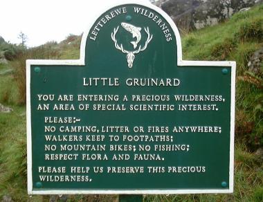
Little Gruinard — The Little Gruinard is a river in Wester Ross, Scotland which runs from the Fionn Loch into Gruinard Bay (famed for Gruinard Island). It lies within the Letterewe Estate, previously owned by Paul van Vlissingen, a Dutch businessman. It has a… … Wikipedia
 Letterewe Estate Sign