Guarani International Airport
- Guarani International Airport
Infobox Airport
name = Guarani International Airport
nativename = _es. Aeropuerto Internacional "Guaraní"
IATA = AGT
ICAO = SGES
type = Public / Military
owner =
operator =
city-served = Ciudad del Este, Paraguay
location =
elevation-f = 846
elevation-m = 258
website =
metric-rwy = y
r1-number = 05/23
r1-length-m = 3,400
r1-length-f = 11,154
r1-surface = Asphalt
footnotes = Source: DAFIF[WAD|SGES|source=DAFIF] ][GCM|AGT|source=DAFIF] ]
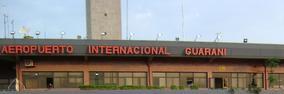
Guarani International Airport ( _es. Aeropuerto Internacional "Guaraní") airport codes|AGT [ASN|AGT] |SGES [es icon [http://www.dinac.gov.py/aeropuertos/aeropuertos.php "Dirección Nacional de Aeronáutica" (DINAC)] ] is an international airport serving Ciudad del Este, a city in the Alto Paraná Department of Paraguay.
The airport is Paraguay's second most important national and international airport.
Airlines and destinations
*Regional Paraguaya (Asunción [begins November 1] , Buenos Aires-Ezeiza [begins November 1] , Sao Paulo-Guarulhos [begins November 1] )
*TAM Paraguayan Airlines (Asunción, Buenos Aires-Ezeiza, Córdoba, Santiago de Chile, São Paulo-Guarulhos)
Formerly serving airlines
Domestic
*flagicon|Paraguay ARPA - Aerolineas Paraguayas [defunct] (Asuncion, Pedro Juan Caballero)
References
External links
*es [http://www.dinac.gov.py/aeropuertos/aeropuertos_gcde.php Guarani International Airport]
Wikimedia Foundation.
2010.
Look at other dictionaries:
Dr. Augusto Roberto Fuster International Airport — Coordinates: 22°38′29″S 055°49′47″W / 22.64139°S 55.82972°W / 22.64139; 55.82972 … Wikipedia
Dr. Luis María Argaña International Airport — Dr. Luis Maria Argaña International Airport Aeropuerto Dr. Luis Maria Argaña IATA: ESG – ICAO: SGME Summary Airport type Military/Public Serves … Wikipedia
Guaraní Aquifer — The Guaraní Aquifer, located beneath the surface of the original four Mercosur countries (Argentina, Brazil, Paraguay and Uruguay), is one of the world s largest aquifer systems and an important source of fresh water for its people. [… … Wikipedia
Minga Guazú — Flag … Wikipedia
TAM Airlines (Paraguay) — Infobox Airline airline=TAM Airlines (Paraguay) logo=TAMairlinesLogo.gif logo size=135px IATA=PZ ICAO=LAP callsign=Paraguaya parent=TAM founded=1962 headquarters=Asunción, Paraguay key people=Capt. David Barioni Neto (CEO) hubs=Silvio Pettirossi… … Wikipedia
Liste der IATA-Codes/A — Diese Teilliste führt alle IATA Flughafen Codes auf, die mit „A“ beginnen, und enthält Informationen zu den bezeichneten Verkehrsknotenpunkten. IATA Codes A B C D E F G H I J K L M N O P Q … Deutsch Wikipedia
Minga Guazú — 25.484722222222 54.766944444444 Koordinaten: 25° 29′ S, 54° 46′ W Minga Guazú Minga Gu … Deutsch Wikipedia
Economy of Paraguay — The economy of Paraguay is marked by the dominance of the farming, commercial and service sectors. Industry, however, is less well developed, and mostly based on the processing of agricultural goods.The commercial sector is supported by shopping… … Wikipedia
Alto Paraná Department — Alto Paraná is a department in Paraguay. The capital is Ciudad del Este (formerly known as Puerto Presidente Stroessner, originally Puerto Flor de Lis). The Alto Paraná department has experienced tremendous economic and population growth in the… … Wikipedia
Regional Paraguaya — Infobox Airline airline=Regional Paraguaya logo= logo size= IATA= ICAO=REP callsign=REGIOPAR parent=AeroRegional Paraguaya, S.A. founded=2008 headquarters=Asunción, Paraguay key people=Salvador Sturno (President) hubs=Silvio Pettirossi… … Wikipedia