Scott Brook Road bridge over the Connecticut River
- Scott Brook Road bridge over the Connecticut River
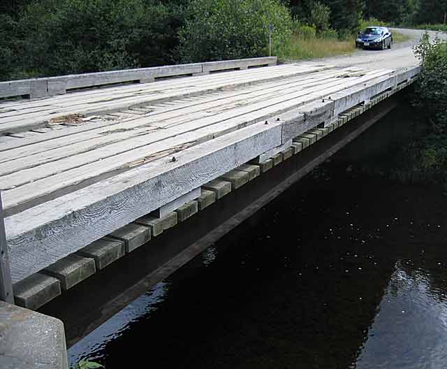
Infobox Bridge
bridge_name=Scott Brook Road Bridge
caption=
official_name=
carries=Scott Brook Road
crosses=Connecticut River
locale=Pittsburg, New Hampshire
maint=International Paper
id=
design=wood-decked steel beam bridge
mainspan=
length=approximately 30 ft
width=
height=
load=
clearance=
below=approximately 4 ft
traffic=
begin=
complete=
open=
closed=
toll=
map_cue=
map_
map_text=
map_width=
coordinates= coord|45|10|54|N|71|10|38|W|type:landmark|display=inline,title
lat=
long=
The Scott Brook Road Bridge is a wood-decked steel beam bridge over the Connecticut River located in Pittsburg, New Hampshire. It carries Scott Brook Road, where most traffic is logging trucks, hunters, and anglers. It's an example of a simple bridge.
ee also
List of crossings of the Connecticut River
References
Crossings navbox
structure = Crossings
place = Connecticut River
bridge = Scott Brook Road Bridge
bridge signs =
upstream = US Route 3 Bridge
upstream signs =
downstream = Magalloway Road
downstream signs =
Wikimedia Foundation.
2010.
Look at other dictionaries:
Magalloway Road Bridge over the Connecticut River — Magalloway Road Bridge Carries Magalloway Road Crosses Connecticut River Locale Pittsburg, N … Wikipedia
U.S. Route 3 Bridge over the Connecticut River — Infobox Bridge bridge name=US Route 3 Bridge caption= official name= carries= crosses=Connecticut River locale=Pittsburg maint= id= design=concrete beam bridge mainspan= length= width= height= load= clearance= below= traffic= begin= complete=… … Wikipedia
List of crossings of the Connecticut River — Railroad bridge over the Connecticut, Old Saybrook, postcard mailed in 1908 This is a list of bridges and other crossings of the Connecticut River from its mouth at Long Island Sound upstream to its source at the Connecticut Lakes. The list… … Wikipedia
Connecticut River Greenway State Park — consists of a number of separate state land holdings in the Pioneer Valley of western Massachusetts. The park includes critical wildlife and plant habitat as well as areas providing public access to the Connecticut River. The Department of… … Wikipedia
U.S. Route 5 in Connecticut — This article is about the section of U.S. Route 5 in Connecticut. For the entire length of the highway, see U.S. Route 5. U.S. Route 5 … Wikipedia
Petitcodiac River — Petitcodiac River … Wikipedia
New Haven, Connecticut — New Haven redirects here. For other uses, see New Haven (disambiguation). City of New Haven City Skyline of Downtown New Haven … Wikipedia
Old Bridge Township, New Jersey — Township Map of Old Bridge Township in Middlesex County. Inset: Locati … Wikipedia
Chapel Brook — Open Space Reserve Location Ashfield, Massachusetts Biome open ledg … Wikipedia
Enfield, Connecticut — Town Thompsonville Village of Enfield, Connecticut … Wikipedia