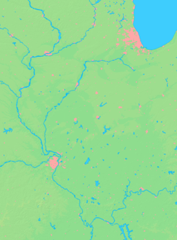
- Maquon, Illinois
-
Maquon Village Country United States State Illinois County Knox Townships Maquon, Haw Creek Coordinates 40°47′54″N 90°9′46″W / 40.79833°N 90.16278°W Area 0.2 sq mi (1 km2) - land 0.2 sq mi (1 km2) Population 318 (2000) Density 1,971.4 / sq mi (761 / km2) Timezone CST (UTC-6) - summer (DST) CDT (UTC-5) Postal code 61458 Area code 309 Wikimedia Commons: Maquon, Illinois Maquon is a village in Knox County, Illinois, United States. The population was 318 at the 2000 census. It is part of the Galesburg Micropolitan Statistical Area.
Contents
Description
Maquon is located along Illinois Highway 97 and Knox County Highway 20 about a mile north of Illinois Highway 8. The site of a Pottawatomi Native American village, Maquon today has a population of 284. Currently, Dennis Parker is the village president, Alan Swearingen village clerk, and Lisa Roberts treasurer. The trustees are Carol Courson, Jim Frame, Kari Nicholas, Tancy Mitchell, Marcy Oglesby and Danny Thomas.
Geography
Maquon is located at 40°47′54″N 90°9′46″W / 40.79833°N 90.16278°W (40.798290, -90.162832).[1]
According to the United States Census Bureau, the village has a total area of 0.2 square miles (0.52 km2), all of it land.
Demographics
As of the census[2] of 2010, there were 284 people, 139 households, and 82 families residing in the village. The population density was 1,971.4 people per square mile (767.4/km²). There were 146 housing units at an average density of 905.1 per square mile (352.3/km²). The racial makeup of the village was 98.43% White, 0.63% Asian, 0.31% from other races, and 0.63% from two or more races. Hispanic or Latino of any race were 3.14% of the population.
There were 139 households out of which 33.1% had children under the age of 18 living with them, 42.4% were married couples living together, 9.4% had a female householder with no husband present, and 40.3% were non-families. 38.1% of all households were made up of individuals and 19.4% had someone living alone who was 65 years of age or older. The average household size was 2.29 and the average family size was 2.93.
In the village the population was spread out with 26.4% under the age of 18, 6.0% from 18 to 24, 27.4% from 25 to 44, 23.3% from 45 to 64, and 17.0% who were 65 years of age or older. The median age was 37 years. For every 100 females there were 78.7 males. For every 100 females age 18 and over, there were 80.0 males.
The median income for a household in the village was $32,917, and the median income for a family was $36,563. Males had a median income of $29,375 versus $22,000 for females. The per capita income for the village was $15,199. About 5.1% of families and 10.3% of the population were below the poverty line, including 11.8% of those under age 18 and 11.1% of those age 65 or over.
References
- ^ "US Gazetteer files: 2010, 2000, and 1990". United States Census Bureau. 2011-02-12. http://www.census.gov/geo/www/gazetteer/gazette.html. Retrieved 2011-04-23.
- ^ "American FactFinder". United States Census Bureau. http://factfinder.census.gov. Retrieved 2008-01-31.
External links
Municipalities and communities of Knox County, Illinois Cities Villages Altona | East Galesburg | Henderson | London Mills‡ | Maquon | Rio | St. Augustine | Victoria | Wataga | Williamsfield | Yates City
Townships Unincorporated
communitiesGhost town Etherly
Footnotes ‡This populated place also has portions in an adjacent county or counties
Categories:- Populated places in Knox County, Illinois
- Villages in Illinois
- Galesburg micropolitan area
Wikimedia Foundation. 2010.


