- Trevelin
-
This article is about the town in Argentine. For the public relations firm, see Trevelino/Keller.
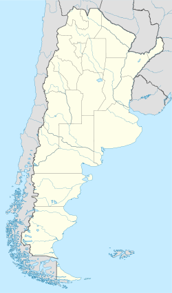
Trevelin — Town — A winter day in Trevelin Location of Trevelin in Argentina Coordinates: 43°5′S 71°28′W / 43.083°S 71.467°WCoordinates: 43°5′S 71°28′W / 43.083°S 71.467°W Country Argentina Province Chubut Department Futaleufú Population – Total 6,395 Time zone ART (UTC-3) CPA base U9203 Dialing code +54 2945 Trevelin (Welsh: Trefelin) is a town in the Patagonian Argentine province of Chubut. It is located in the department of Futaleufú, south of Esquel, and had about 6,400 inhabitants at the time of the 2001 census [INDEC].
The town was important in the Welsh settlement of Chubut. It was named Trevelin (from Trefelin, the Welsh for "mill town") after the first mill, known as "Los Andes", was established there by John Evans in 1889. One of the tourist attractions of Trevelín is the grave of Malacara, Evans' horse, who a few years earlier in 1884 had saved his master's life by a prodigious leap. In 1902, following a territorial dispute between Argentina and Chile, the inhabitants of the area voted to remain in Argentina.[citation needed]
The town, in the Valley of the 16th of October (Welsh: Cwm Hyfryd/Bro Hydref), is near the Percy river, which flows south into the Río Grande, crosses the frontier with Chile, and thereafter is known as the Río Futaleufú.
References
- Municipal information: Municipal Affairs Federal Institute (IFAM), Municipal Affairs Secretariat, Ministry of Interior, Argentina. (Spanish)
Categories:- Populated places in Chubut Province
- Populated places established in 1888
- Chubut Province geography stubs
Wikimedia Foundation. 2010.


