- ʻAiea, Hawaii
Infobox Settlement
official_name = okinaAiea, Hawaiokinai
other_name =
native_name =
nickname =
settlement_type = CDP
motto =
imagesize =
image_caption =
flag_size =
image_
seal_size =
image_shield =
shield_size =
image_blank_emblem =
blank_emblem_type =
blank_emblem_size =
imagesize =
image_caption =
flag_size =
image_
seal_size =
image_shield =
shield_size =
image_blank_emblem =
blank_emblem_type =
blank_emblem_size =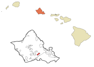
mapsize =
map_caption = Location in Honolulu County and the state ofHawaii
mapsize1 =
map_caption1 =
image_dot_
dot_mapsize =
dot_map_caption =
dot_x =
dot_y =
pushpin_
pushpin_label_position =
pushpin_map_caption =
pushpin_mapsize =
subdivision_type = Country
subdivision_name =United States
subdivision_type1 = State
subdivision_name1 =Hawaii
subdivision_type2 = Counties
subdivision_name2 = Honolulu
subdivision_type3 =
subdivision_name3 =
subdivision_type4 =
subdivision_name4 =
government_footnotes =
government_type =
leader_title =
leader_name =
leader_title1 =
leader_name1 =
leader_title2 =
leader_name2 =
leader_title3 =
leader_name3 =
leader_title4 =
leader_name4 =
established_title =
established_date =
established_title2 =
established_date2 =
established_title3 =
established_date3 =
area_magnitude =
unit_pref = Imperial
area_footnotes =
area_total_km2 = 4.6
area_land_km2 = 4.3
area_water_km2 = 0.3
area_total_sq_mi = 1.8
area_land_sq_mi = 1.7
area_water_sq_mi = 0.1
area_water_percent =
area_urban_km2 =
area_urban_sq_mi =
area_metro_km2 =
area_metro_sq_mi =
area_blank1_title =
area_blank1_km2 =
area_blank1_sq_mi =
population_as_of = 2000
population_footnotes =
population_note =
population_total = 9019
population_density_km2 = 1960.7
population_density_sq_mi = 5010.6
population_metro =
population_density_metro_km2 =
population_density_metro_sq_mi =
population_urban =
population_density_urban_km2 =
population_density_urban_sq_mi =
population_blank1_title =
population_blank1 =
population_density_blank1_km2 =
population_density_blank1_sq_mi =
timezone =
utc_offset =
timezone_DST =
utc_offset_DST =
latd=
latm=
lats=
latNS=
longd=
longm=
longs=
longEW=
elevation_footnotes =
elevation_m =
elevation_ft =
postal_code_type =
postal_code =
area_code =
blank_name =
blank_info =
blank1_name =
blank1_info =
website =
footnotes =okinaAiea (IPA2|ʔai.ea) is a
census-designated place (CDP) located in Honolulu County, Hawaiokinai. As of the 2000 Census, the CDP had a total population of 9,019.At 41.41% of residents reporting the ancestry, okinaAiea contains the largest concentration of persons of Japanese heritage in the United States.Fact|date=April 2008
Some residents of okinaAiea claim that their town is the only town in the world spelled entirely with vowels. This claim may or may not be valid, depending on whether or not one regards the okinaokina to be part of the name "okinaAiea". Because the "okinaokina" is considered a consonant in the
Hawaiian language , this claim is technically incorrect. Fact|date=April 2008 However, when people outside of Hawaiokinai speak of okinaAiea, the "okinaokina" is typically omitted. In this context, the claim that okinaAiea is spelled only with vowels is true. However, there are many other towns in the world spelled with only vowels, including but not limited toEa, Spain andAue inGermany , several towns in Norway and Sweden named Å, and a village, forest and valley inScotland called Ae. There is also a village named Y inFrance .The U.S.
postal code for okinaAiea is 96701.Geography
okinaAiea is located at coor dms|21|23|9|N|157|55|51|W|city (21.385900, -157.930927)GR|1. According to the
United States Census Bureau , the CDP has a total area of 1.8square mile s (4.5km² ), of which, 1.6 square miles (4.3 km²) of it is land and 0.1 square miles (0.3 km²) of it is water. The total area is 5.71% water. Although okinaAiea as a census district may be only the small 4.5 km² noted above, most residents, when describing "okinaAiea," are referring to most of the northern shore of East Loch ofPearl Harbor to okinaAiea Bay, including the associated uplands rising to the north into the Kookinaolau Mountains.Kamehameha Highway (Hawaii Route 90 ) divides most of okinaAiea from the shore of Pearl Harbor (mostly US government property), and the parallel major thoroughfare,Interstate H-1 , further cuts the town's commercial district into two distinct areas. These east-west routes (and other streets, such as Moanalua Road) connect okinaAiea to Pearl City immediately adjacent on the west and Hālawa adjacent on the east. The residential area known as okinaAiea Heights extends up the ridgeline above the town. The communities of Newtown Estates and Royal Summit are located at the western edge of okinaAiea near its border withPearl City at Kaokinaahumanu Street. Residents of thecensus-designated place s (CDP) ofWaimalu and Hālawa use okinaAiea in their postal address.History
okinaAiea was originally the name of an "ahupuaokinaa", or Hawaiian land division. It stretched from okinaAiea Bay (part of Pearl Harbor) into the mountains to the north. At the end of the 19th century, a
sugar cane plantation was opened in the district by the Honolulu Plantation Company.As okinaAiea has several miles of shoreline on Pearl Harbor, the focus of the 7 December 1941 attack by the Japanese on military installations there greatly impacted the town. For example, one damaged ship, the "
USS Vestal ", beached at okinaAiea Bay to prevent sinking. Many photographers photographed the battle from the hills in okinaAiea.After World War II the plantation shut down and the mill was converted into a sugar refinery. Meanwhile, developers started extending the town into the surrounding former sugar cane fields. In the years since then, okinaAiea has grown into an important suburb of Honolulu. The town's sugar history came to a close in 1996, when C&H Sugar closed the refinery. Then in 1998, the 99-year old sugar mill was torn down by the owners, amid protests from town residents and the County government.
Demographics
As of the
census GR|2 of 2000, there were 9,019 people, 2,758 households, and 2,258 families residing in the CDP. Thepopulation density was 5,463.5 people per square mile (2,110.5/km²). There were 2,831 housing units at an average density of 1,714.9/sq mi (662.5/km²). The racial makeup of the CDP was 16.25% White, 0.85% Black or African American, 0.14% Native American, 58.31% Asian, 5.08% Pacific Islander, 0.77% from other races, and 18.59% from two or more races. 5.47% of the population were Hispanic or Latino of any race.There were 2,758 households out of which 27.3% had children under the age of 18 living with them, 63.0% were married couples living together, 13.3% had a female householder with no husband present, and 18.1% were non-families. 13.9% of all households were made up of individuals and 7.7% had someone living alone who was 65 years of age or older. The average household size was 3.24 and the average family size was 3.51.
In the CDP the population was spread out with 21.2% under the age of 18, 6.4% from 18 to 24, 27.6% from 25 to 44, 23.1% from 45 to 64, and 21.7% who were 65 years of age or older. The median age was 42 years. For every 100 females there were 96.3 males. For every 100 females age 18 and over, there were 96.0 males.
The median income for a household in the CDP was $71,155, and the median income for a family was $75,992. Males had a median income of $41,384 versus $32,394 for females. The
per capita income for the CDP was $25,111. 4.6% of the population and 3.4% of families were below thepoverty line . Out of the total population, 8.1% of those under the age of 18 and 4.0% of those 65 and older were living below the poverty line.Attractions
okinaAiea is the home of
Pearlridge , Hawaiokinai's largest enclosed shopping center and second largest shopping center in the state. The mall is separated into two sections, known as Uptown and Downtown, includes the onlymonorail in Hawaiokinai, the only hospital located on mall property (Kapiokinaolani Medical Center at Pali Momi), and Hawaiokinai's largestwatercress farm (Sumida Farm).okinaAiea is also home to
Aloha Stadium , home of the University of Hawaiokinai Warriors football team, and the host site for the Hawaiokinai Bowl every December and theNational Football League 'sPro Bowl every February.okinaAiea is also the home to Keiwa Heiau, an ancient
medicine shrine. Also there is a 4.5mile loop trail. AWorld War II plane crashed in the trail and can be seen halfway through.Education
All areas of Hawaiokinai are served by public schools of the Hawaiokinai Department of Education.Specifically, okinaAiea is served by okinaAiea High School, okinaAiea Intermediate School, and five elementary schools - okinaAiea Elementary, Alvah A. Scott Elementary, Waimalu Elementary, Pearl Ridge Elementary, and Gus Webling Elementary.
References
External links
Wikimedia Foundation. 2010.