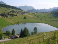
- Lac des Confins
-
Lac des Confins 
Location Haute-Savoie Coordinates 45°54′57″N 6°28′34″E / 45.91583°N 6.47611°ECoordinates: 45°54′57″N 6°28′34″E / 45.91583°N 6.47611°E Basin countries France Lac des Confins is located just below the station of La Clusaz. The lake is situated at the foot of the Aravis Range. Nearby is the Pointe Percée.
Every year, at the end of the skiing season, there is a light-hearted descent. The skiers run down the hills towards the lake as fast as they can, the idea being to see who can jump the furthest into the lake. All participants are encouraged.
Categories:- Haute-Savoie geography stubs
- Haute-Savoie
- Lakes of Rhône-Alpes
Wikimedia Foundation. 2010.
