- Tjebu
-
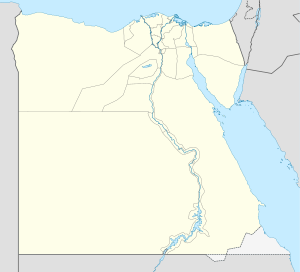
Tjebu Location in Egypt Coordinates: 26°54′N 31°31′E / 26.9°N 31.517°E Country  Egypt
EgyptGovernorate Sohag Governorate Time zone EST (UTC+2) Tjebu or Djew-Qa is an ancient Egyptian city, located on the eastern bank of the Nile, in the modern Sohag governorate. In the Greco-Roman period, its name was Antaeopolis, and its modern name is Qaw el-Kebir.
Several large terraced funerary complexes in Tjebu by officials of the 10th Nome during the Twelfth and Thirteenth Dynasties represent the peak of nonroyal funerary architecture of the Middle Kingdom. Cemeteries of different dates were also found in the area. A Ptolemaic temple of Ptolemy IV Philopator, enlarged and restored under Ptolemy VI Philometor and Marcus Aurelius, was destroyed in the first half of the 19th century.
The temple in this town was large, comparatively speaking--an 18-column pronaos, with a twelve column hypostyle hall preceding the vestibule hall, the inner sanctum, and two flanking chambers of equal size (Description de l'Egypte, pp. 422-425). The edifice was dedicated primarily to Antiwey--a warrior-like deity who represented a sort of fusion or "middle ground," so to speak, in the personalities of Seth and Horus. Nephthys was the primary goddess who received worship in this temple, or perhaps in an adjunct shrine of her own, as the corresponding female power of Antiwey. A "Prophet of Nephthys" is attested for this town (cf. Lexikon der A, E. Graefe, Nephthys, Chicago Stele).
To this day, in cliffside quarries not far from the ancient site, visitors with mettle can forge onward to see notable reliefs of both Antaeus (Antiwey) and Nephthys, the great deities of the ancient community (cf. Baedeker, 1902, etc.). At the same time, the site has again drawn most of its interest since 19th and early 20th century archaeologists have studied the maze of relatively well-preserved tombs in the district (cf. PETRIE, FLINDERS, Antaeopolis the Tombs of Qau (Egypt) London, Quaritch 1930).
Categories:- Cities in Ancient Egypt
- Populated places in Egypt
- Former populated places in Egypt
Wikimedia Foundation. 2010.

