- Iinan, Shimane
Japanese city
Name = Iinan Town
JapaneseName = 飯南町
Prefecture =Shimane Prefecture
Region =Chūgoku
Area_km2 = 242.84
Population = 6,013
PopDate =January 1 ,2007
Density_km2 = 24.76
Coord =
Postal code =
Area code =
Mayor =
Tree =Beech
Flower =Peony
Bird =
Symbol
CityHallPostalCode = 690-3513
CityHallAddress = Iinan-machi, 890 Shimoakana
CityHallPhone = 0854-76-2211
CityHallLink = [http://www.iinan.jp/ Iinan Town]
City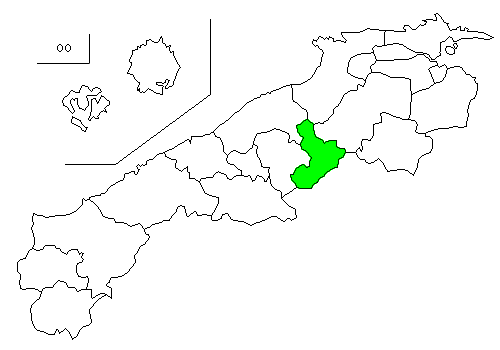
Elevation =nihongo|Iinan|飯南町|Iinan-chō is a town located in the Iishi District in
Shimane Prefecture ,Japan . It was formed onJanuary 1 ,2005 from the merger of the towns of Tonbara and Akagi.As of
January 1 ,2007 the town has apopulation of 6,013 and a density of 24.76 persons per km². The area is 242.84 km².Geography
Located on the border of Shimane Prefecture and
Hiroshima Prefecture , the Gōno River flows to its west. The town is part of the Hiba-Dōgo-Taishaku Quasi-National Park.citebook|page=25|title=考える社会科地図 Kangaeru Shakaika Chizu|year=2005|publisher=四谷大塚出版 Yotsuya-Ōtsuka Shuppan]Mountains :Mount KotohikiRivers :Akagi River, Tonbara RiverLakes :Lake KurushimaSurrounding municipalities
*
Shimane Prefecture
** Izumo
** Misato
** Unnan
** Ōda
*Hiroshima Prefecture
** MiyoshiTransportation
National Highways
* National Highway 54
* National Highway 184Roadside Stations
* Roadside Station Akagi Plateau *Roadside Station TonbaraThere is no railroad access to Iinan.
Notable places
*Akana Castle
*:It is an old castle located on top of a hill in the Akana area of the town.
*Mount Onakame
*:Situated on the border of Hiroshima Prefecture and Shimane Prefecture, Mount Onakame has an elevation of 830.3m. It is known for being the only place in theChūgoku Region in which Luehdorfia are found. [ja icon [http://www.iinan.jp/touristinfo/forest/index3.html おかえりなさい!:島根県飯南町観光WEB ] ]
*Mount Kotohiki
*:Mount Kotohiki has an elevation of 1014m. Near the summit of the mountain is a small shrine and a forest of beech trees. The name "Kotohiki" comes from the traditional Japanese musical instrument, the "koto". [ja icon [http://www.iinan.jp/touristinfo/forest/index2.html おかえりなさい!:島根県飯南町観光WEB ] ]
*Akana Marshland
*:The Akana Marshland is located in the Fukuda Area of the town, and is centered in Lake Nagao. It is known for having the largest forest ofalders in the prefecture. [ja icon [http://www.iinan.jp/touristinfo/forest/index5.html おかえりなさい!:島根県飯南町観光WEB ] ]
*Kotohiki Camp Area
*:The Kotohiki Camp Area is located at the foot of Mount Kotohiki. It is open from late April to late October. [ja icon [http://www.iinan.jp/touristinfo/nature/index.html おかえりなさい!:島根県飯南町観光WEB ] ]References
External links
* [http://www.iinan.jp/ Town of Iinan]
Wikimedia Foundation. 2010.