- Bentley Brook
Geobox|River
name = Bentley Brook
native_name =
other_name =
other_name1 =
image_size =
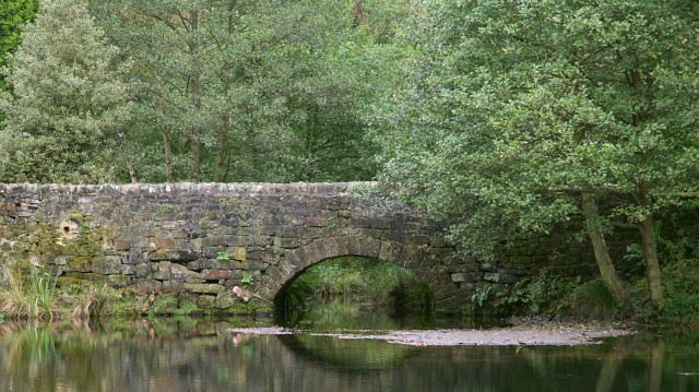
image_caption = Bridge carrying Oaksedge Lane over Bentley Brook as it enters the reservior
country = England | country_
country1 =
state =
state1 =
region =Derbyshire
region1 =
region2 =
region3 =
region4 =
district =
district1 =
district2 =
district3 =
district4 =
city =
city1 =
length =
watershed =
discharge_location =
discharge_average =
discharge_average_note =
discharge_max =
discharge_max_note =
discharge_min =
discharge1_location =
discharge1_average =
source_name =
source_location =Matlock Moor
source_district =
source_region =
source_state =
source_country =England
source_country_
source_lat_d =
source_lat_m =
source_lat_s =
source_lat_NS =
source_long_d =
source_long_m =
source_long_s =
source_long_EW =
source_elevation =
source_length =
mouth_name =
mouth_location =
mouth_district =
mouth_region =Derbyshire
mouth_state =
mouth_country = England
mouth_country_
mouth_lat_d =
mouth_lat_m =
mouth_lat_s =
mouth_lat_NS =
mouth_long_d =
mouth_long_m =
mouth_long_s =
mouth_long_EW =
mouth_elevation =
tributary_left =
tributary_left1 =
tributary_right =
tributary_right1 =
free_name = Classed as
free_value = main river
map_size =
map_caption =Bentley Brook is a stream located in
Derbyshire ,England . [ [http://www.derbyshire-peakdistrict.co.uk/ashbournewalk.htm derbyshire-peakdistrict.co.uk] ] It starts on Matlock Moor then flows south, throughCuckoostone Dale , under the A632, into Lumsdale where it enters the now disused mill pond and then the waterfall. Finally, it flows into theRiver Derwent , just beyond Hall Leys park, Matlock. It is classed as a 'main river' by theEnvironment Agency . [ [http://www.derbyshiredales.gov.uk/LeisureCulture/ParksRecreation/Rivers/ derbyshiredales.gov.uk] ]Water Mills
The brook flows through the wooded gorge of
Lumsdale Valley and is notable for being the site of six now disusedwater wheels and three mill ponds - perhaps the most concentrated evidence of earlywater power inGreat Britain . [ [http://www.peakdistrictview.com/?page=a_lumsdale peakdistrictview.com] ] The power of the stream was harnessed by generations of mills in the valley which operated over several centuries. The now overgrown ruins of Bone Mill can be dated back to the 16th century and was used to grind animal bones for fertiliser up to the 1920s. The wheel pit still remains, as does the tail race which leads back into Bentley Brook. A second mill dates from 1850s and was used as a saw mill at the turn of the 20th century while the Lower Dam was built in 1830 to harness the brook using a mill stone imported theMassif Central in France. The "Paint Mill" was used to grind barytes for the paint industry and has been largely preserved by theArkwright Society . It was also used to smelt lead, grind corn and as a bleaching mill.A fifth mill on Bentley Brook, known as Upper Bleach Mill retains the remains of its bleaching vats and was linked to the last of the mills, Garton Mill, by an ingenious train system which carried loads of heavy cotton between the two. Garton Mill, the largest and preserved in the series, was built around 1785 by Watts Lowe and Co as a
cotton spinning mill. The whole water system of the valley was altered to support this mill but it was not a commercial success and the company went bankrupt in 1813. The valley was then sold to John Garton who converted the mill into a bleaching mill, where it functioned along with other textile finishing mills until the early 20th century.The power of the brook has carved an impressive series of waterfalls out of the limestone but the force of the water has led to tragedy in the past. On December 10 1965 heavy rain caused major flooding in Derbyshire, leading to three fatalities, including a 58-year-old railway worker, George Ellis, who was found dead in Bentley Brook in Matlock, two days after he had last been seen attempting to cross a flooded car park bordering the brook. [http://www.youandyesterday.co.uk/articles/Derbyshire:_Worst_floods_of_the_century source] ]
ee also
*
List of rivers in England References

Wikimedia Foundation. 2010.