- Myloi, Argolis
-
Myloi
Μύλοι
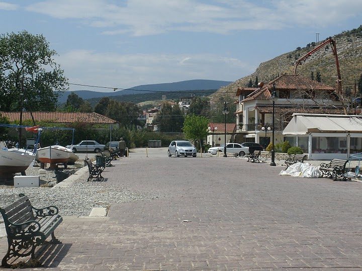
A view of Myloi from the quayLocation 
 Myloi
MyloiCoordinates 37°33′N 22°43′E / 37.55°N 22.717°ECoordinates: 37°33′N 22°43′E / 37.55°N 22.717°E Government Country: Greece Region: Peloponnese Regional unit: Argolis Municipality: Argos-Mykines Municipal unit: Lerna Population statistics (as of 2001) Community - Population: 921 Other Time zone: EET/EEST (UTC+2/3) Elevation (center): 29 m (95 ft) Postal: 212 00 Telephone: 27510 Auto: AP Myloi (Greek: Μύλοι), is a village and the seat of the former municipality of Lerna in the southwestern part of Argolis, Greece. The old GR-7 is about 100 m from the train station of Myloi and is also accessible by a rare road linking Nea Kios - Nafplio and the rest of central and eastern Argolis. It is located about 62 km SSW of Corinth, about 6 km SW of Argos, about 140 km WSW of Athens, about 13 km W of Nafplio and about 55 km E of Tripoli. It is located next to the northwestern part of the Argolic Gulf.
Myloi has a school, a church, a post office, a train station (on the line of Kalamata - Tripoli - Argos - Corinth) west of the square, a port and a square (plateia). The village also has a spring in the area. It also had campgrounds until about five years ago.
Much of the area in the northeast is used for farming while forests surround the town and the coastline. The rocky landscape of the mountains lie to the west.
Myloi also has a lake and a castle.
The settlement of Myloi dates back to around 2500 BC. For the earlier history of Lerna, see Lerna.
References
See also
- Communities of Argolis
Categories:- Populated places in Argolis

Wikimedia Foundation. 2010.