Ningerum

Ningerum
Ningerum
Western Province
Papua New Guinea
Ningerum.png
Ningerum township from space
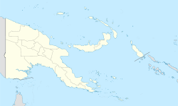
Ningerum is located in Papua New Guinea
{{{alt}}}
Ningerum
District:
North Fly
LLG:
Niingerum Rural
Coordinates: 5°40′S 141°8′E / 5.667°S 141.133°E / -5.667; 141.133Coordinates: 5°40′S 141°8′E / 5.667°S 141.133°E / -5.667; 141.133
Population: 5000 (2006 est) (26th)
Main languages: Tok Pisin, English
Language area: Ninggerum
Elevation: 90 m (295 ft)

Ningerum is a small town on the Kiunga-Tabubil Highway, about equidistant between the two centres of Kiunga and Tabubil. Ningerum is the seat of the Ningerum Rural LLG, which was the second most populous LLG in the North Fly District of the Western Province of Papua New Guinea during the 2000 census. The town is served by Ningerum Airport.

The township itself has a population of roughly 5000 people, a few regional stores and an airport. The Ningerum is also the name for the people inhabiting this region who are noted for their therapeutic knowledge.[1]

References


Wikimedia Foundation. 2010.

Игры ⚽ Поможем написать реферат

Look at other dictionaries:

  • Ningerum Rural LLG — Location of Ningerum Rural LLG in the North Fly district of the Western Province of Papua New Guinea The Ningerum Rural LLG is a local level government area situated in the North Fly District of the Western Province of Papua New Guinea. In the… …   Wikipedia

  • North Fly District —   District   District locator Country …   Wikipedia

  • North Fly District, Western Province — Infobox Papua New Guinea District name = North Fly province = wes capital = The North Fly District of the Western Province of Papua New Guinea is the northernmost, smallest, and arguably the most remote of the three districts of the province. It… …   Wikipedia

  • Kiunga-Tabubil Highway — Infobox PNG Road road name = Kiunga Tabubil Highway type = highway province = wes photo = Kiunga whirlwind cropped.png caption = Kiunga, with the Fly River in the foreground, right, Ningerum station, Tabubil and the Ok Tedi River shown top… …   Wikipedia

  • Ok Tedi River — This article is about the Ok Tedi River. For the Mine, see Ok Tedi Mine. Coordinates: 6°10′5″S 141°7′8.5″E / 6.16806°S 141.119028°E / …   Wikipedia

  • Western Province (Papua New Guinea) — Infobox Papua New Guinea Province name = Western Province othername = Fly River Province districts = capital = Daru area = 99,300 km² arearank = 1st pop = 153,304 popdate = 2000 poprank = 15th popdens = 1.5 governor = Bob Danaya governordate =… …   Wikipedia

  • List of towns in Papua New Guinea — The following is a list of towns in Papua New Guinea.*Abau *Aitape *Alexishafen *Alotau *Ambunti *Angoram *Arawa *Balimo *Bereina *Bogia *Buin *Bulolo *Dagua *Daru *Finschhafen *Goroka *Hoskins *Hula *Kainantu *Kavieng *Kerema *Kieta *Kimbe… …   Wikipedia

  • Ok Tedi Environmental Disaster — The Ok Tedi Environmental Disaster is a term used to describe the ongoing effect of mining on the environment near the Ok Tedi River in Papua New Guinea, particularly the dumping of tailings into the river itself. Although this has been occurring …   Wikipedia

  • Districts and LLGs of Papua New Guinea — Districts and LLGs of Papua New Guinea …   Wikipedia

  • Olsobip Rural LLG — Location of Olsobip Rural LLG in the North Fly district of the Western Province of Papua New Guinea The Olsobip Rural LLG is a local level government situated in the North Fly District of the Western Province of Papua New Guinea. In the year 2000 …   Wikipedia

Share the article and excerpts

Direct link
Do a right-click on the link above
and select “Copy Link”