- Tachov
Geobox | Settlement
name = Tachov
other_name =
category = Town
image_caption =
 | flag_border = 1
symbol = Tachov znak.jpg
etymology =
official_name =
motto =
nickname =
country = Czech Republic
country_
state =
region = Plzeň
region_type = Region
district = Tachov
district_type = District
commune = Tachov
municipality =
part_fold = 1
part = Bíletín
part1 = Malý Rapotín
part2 = Mýto
part3 = Oldřichov
part4 = Světce
part5 = Tachov
part6 = Velký Rapotín
part7 = Vítkov
river = Mže
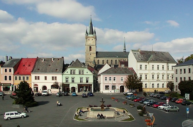
location = Náměstí Republiky
elevation = 483
lat_d = 49
lat_m = 47
lat_s = 43
lat_NS = N
long_d = 12
long_m = 37
long_s = 59
long_EW = E
highest =
highest_elevation =
highest_lat_d =
highest_long_d =
lowest =
lowest_elevation =
lowest_lat_d =
lowest_long_d =
area = 40.85
area_round = 2
population = 13017
population_date = 2006
population_density = auto
established = 1115
established_type = First mentioned
mayor = Ladislav Macák
timezone =
map_background = Czechia - background map.png
map_locator = Czechia
commons = Tachov
statistics =
website = [http://www.tachov-mesto.cz/ www.tachov-mesto.cz]
footnotes =
name = Tachov
native_name =
other_name =
other_name1 =
category = Municipality with Extended Competence
image_size =
image_caption =
flag_size =
symbol =
symbol_size =
country = Czech Republic
state =
region = Pilsen
district =
capital =
capital_lat_d =
capital_lat_m =
capital_lat_s =
capital_lat_NS =
capital_long_d =
capital_long_m =
capital_long_s =
capital_long_E =
capital_elevation =
part_type =
part_label = Municipalities with Commissioned Local Authority
part_count = 3
part = Bor
part1 = Planá u Mariánských Lázní
part2 = Tachov
area = 947.92
area_round = 2
highest =
highest location =
highest_lat_d =
highest_lat_m =
highest_lat_s =
highest_lat_NS =
highest_long_d =
highest_long_m =
highest_long_s =
highest_long_EW =
highest_elevation =
lowest =
lowest_location =
lowest_lat_d =
lowest_lat_m =
lowest_lat_s =
lowest_lat_NS =
lowest_long_d =
lowest_long_m =
lowest_long_s =
lowest_long_EW =
lowest_elevation =
population_as_of = 2005-31-12
population = 35140
population_density = auto
established_type =
established =
leader =
timezone =
utc_offset =
timezone_DST =
utc_offset_DST =
code_type =
code =
code1_type =
code1 =
free_type =
free =
free1_type =
free1 =
_-_location_map.png)
map_size =
map_caption =
map_locator =
map_locator_x =
map_locator_y =
website =
footnotes = Geobox Region
geobox_width = 270
name = Tachov
native_name =
other_name =
other_name1 =
category = Municipality with Commissioned Local Authority
image_size =
image_caption =
flag_size =
symbol =
symbol_size =
country = Czech Republic
state =
region = Pilsen
district = Tachov
district_type = Little District
district_label = Municipality with Commissioned Local Authority
capital =
capital_lat_d =
capital_lat_m =
capital_lat_s =
capital_lat_NS =
capital_long_d =
capital_long_m =
capital_long_s =
capital_long_E =
capital_elevation =
part_type = Municipalities
part_label =
part_count = 12
part = Ctiboř
part1 = Částkov
part2 = Dlouhý Újezd
part3 = Halže
part4 = Hošťka
part5 = Lesná
part6 = Lom u Tachova
part7 = Milíře
part8 = Obora
part9 = Studánka
part10 = Tachov
part11 = Tisová
area = 293.11
area_round = 2
highest =
highest location =
highest_lat_d =
highest_lat_m =
highest_lat_s =
highest_lat_NS =
highest_long_d =
highest_long_m =
highest_long_s =
highest_long_EW =
highest_elevation =
lowest =
lowest_location =
lowest_lat_d =
lowest_lat_m =
lowest_lat_s =
lowest_lat_NS =
lowest_long_d =
lowest_long_m =
lowest_long_s =
lowest_long_EW =
lowest_elevation =
population_as_of = 2005-12-31
population = 16962
population_density = auto
established_type =
established =
leader =
timezone =
utc_offset =
timezone_DST =
utc_offset_DST =
code_type =
code =
code1_type =
code1 =
free_type =
free =
free1_type =
free1 =
map_size =
map_caption =
map_locator =
map_locator_x =
map_locator_y =
website =
footnotes =Tachov (IPA2|ˈtaxof; _de. Tachau) is a town in the
Pilsen Region of theCzech Republic . It lies on theMže River, some Unit length|km|55 to the west from the region capital ofPilsen .Tachov is also the seat of the Municipality with Extended Competence and the Municipality with Commissioned Local Authority.
History
The area was inhabited by humans around 8,000-6,000 BCE. The first written document mentioning Tachov comes from
1115 . A period of ravishing boom came over the place underPremysl Otakar II who had a new castle with a mighty round tower built of stone here. He also founded a town surrounded with walls near the castle. During theHussite wars the city was several times besieged and conquered. TheThirty Years' War damaged the city considerably. In 1664, Jan A. Losy became the new proprietor and his descendants passed the title to the Windisch-Grätz Family in 1784. The Losys started a conversion of the medieval castle to a large baroque château. The Windisch-Grätzs, in their turn, made large investments to rebuild the house in the classical style.In
1945 most German-speaking inhabitants, the majority in the city, were expelled.After the war, during the Russian occupation, the area was only partly repopulated, not only by Czechs and Slovaks, but also by people from Romania, Ukraine etc. Later on uranium was found here and many adventurers moved to the area to work in the mines.
The mines were closed when the Russians left. After the "Velvet Revolution" (1989), German companies started to operate factories to make use of the cheap labour. However, the Tachov area is still among the economically least developed Czech regions.
External links
* [http://www.tachov-mesto.cz/index.php Official website (in Czech)]
* [http://www.sumava.com/rec_gemeente.php?l=en&dis=p_t Tachov] (in English)
* [http://www.tachov.zde.cz/ Unofficial but informative website with photo gallery (in Czech)]
* [http://www.bohemianet.com/plzensko/tachov/tachov_en.htm History]
* [http://www.tachov.cz/ Portal for this area (in Czech)]Resources
*citation
last = Czech Statistical Office
year = 2005
title = Vybrané údaje podle správních obvodů obcí s rozšířenou působností a správních obvodů obcí s pověřeným obecním úřadem k 31. 12. 2005
url = http://www.czso.cz/xp/redakce.nsf/i/B78124165F6D1D93C1256F1800285EDB/$File/1-vybr.xls
accessdate = 2005-03-08


_-_location_map.svg)
Wikimedia Foundation. 2010.