- Debarq
-
Debarq
ደባርቅLocation in Ethiopia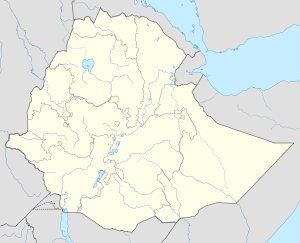
 Debarq
Coordinates: 13°08′N 37°54′E / 13.133°N 37.9°ECoordinates: 13°08′N 37°54′E / 13.133°N 37.9°E Country Ethiopia Region Amhara Region Zone Semien Gondar Zone Elevation 2,850 m (9,350 ft) Population (2005) – Total 24,997 (est) Time zone EAT (UTC+3) Debarq (also spelled Dabareq, Amharic ደባርቅ) is a town in northern Ethiopia. Located 90 kilometers north of Gondar on the paved highway between Gondar and Axum and in the Semien Gondar Zone of the Amhara Region, it has a latitude and longitude of 13°08′N 37°54′E / 13.133°N 37.9°E and an elevation of 2850 meters above sea level.[1]
Debarq is the closest town to the Semien Mountains National Park, and is the location for the park headquarters.
History
Debarq's prosperity was due to its location on the Gondar-Massawa trade route; it is one of the stations on a route of the 1840s, according to a list compiled by Antoine Thomson d'Abbadie in his Geodesie d'Ethiopie.[2] Richard Pankhurst notess that by the early 19th century its market was important enough to be one of six in Ethiopia requiring a nagadras ("head of the market") to oversee it and collect the fees.[3] The revenue from taxes levied on the marketplace in the 1830s paid the governor of Semien province 3,000 Maria Theresa Thalers and about as much to the nagadras.[4]
During a clash with his rebellious nephews, Emperor Tewodros saw his close friend and advisor John Bell killed in battle here in 1860. Although his nephews were killed in the skirmish, and their 1700 followers immediately surrendered, he extracted vengeance the next day by beheading all of their men.[5]
The Tigrayan People's Liberation Front launched an offensive against the 603rd Army Corp of the Derg, and after destroying the government forces stationed at Debarq, they controlled the town 3 January 1989.[5]
Demographics
Based on figures from the Central Statistical Agency, in 2005 Debarq has an estimated total population of 24,997, of whom 11,850 were males and 13,147 were females.[6] The 1994 census reported this town had a total population of 14,474 of whom 6,235 were males and 8,239 were females. It is the largest settlement in Debarq woreda.
References
- ^ Ethiopian Roads Authority, Gondar-Debark Road Project: Review of Environmental Impact Assessment, February 2007, p. 13. The geographical coordinates and elevation for Debarq are disputed: four other possible values are listed at "Local History in Ethiopia" (pdf), The Nordic Africa Institute website
- ^ G.W.B. Huntingford, Historical Geography of Ethiopia from the first century AD to 1704 (London: British Academy, 1989), p. 255.
- ^ Richard Pankhurst, Economic History of Ethiopia (Addis Ababa: Haile Selassie University, 1968), p. 520
- ^ Samuel Gobat, Journal of Three years' Residence in Abyssinia, 1851 (New York: Negro Universities Press, 1969), p. 149
- ^ a b "Local History in Ethiopia," The Nordic Africa Institute website
- ^ CSA 2005 National Statistics, Table B.4
Categories:- Populated places in the Amhara Region
- Semien Mountains

Wikimedia Foundation. 2010.