- Romsdalsalpene
Geobox | Range
name = Romsdalsalpene
native_name =
other_name = Romsdalsfjella
other_name1 =
image_size =
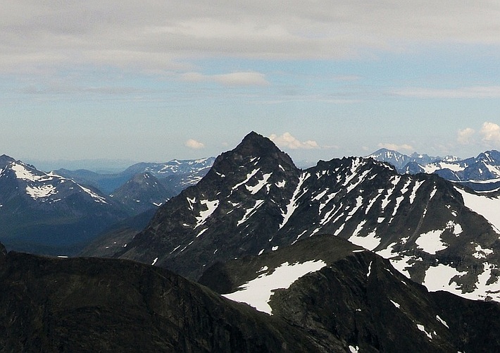
image_caption =Store Venjetinden , highest in Romsdalsalpene
country =Norway
country1 =
state =
state1 =
region =Møre og Romsdal
region_type = County
district =
district1 =
city =
city1 =
unit =
unit1 =
part_count =
part =
part1 =
border =
border1 =
geology =
geology1 =
period =
period1 =
orogeny =
orogeny1 =
area =
length =
length_orientation =
width =
width_orientation =
highest =Store Venjetind
highest location =
highest_country =
highest_state =
highest_region =
highest_district =
highest_elevation = 1852
highest_lat_d =
highest_lat_m =
highest_lat_s =
highest_lat_NS =
highest_long_d =
highest_long_m =
highest_long_s =
highest_long_WE =
lowest =
lowest_location =
lowest_country =
lowest_state =
lowest_region =
lowest_district =
lowest_elevation =
lowest_lat_d =
lowest_lat_m =
lowest_lat_s =
lowest_lat_NS =
lowest_long_d =
lowest_long_m =
lowest_long_s =
lowest_long_WE =
woods =
free_name =
free_value =
map_size =
map_caption =
map_first =Romsdalsalpene is mountain range surrounding the valley
Romsdalen , inMøre og Romsdal ,Norway Mountains in the range include
*Store Venjetind , 1,852 m
*Romsdalshorn , 1,550 m
*Store Trolltind , 1,788 m, highest point along the ridgeTrollryggen
*Kyrkjetaket , 1,439 mExternal links
* [http://www.romsdalsalpene.com www.romsdalsalpene.com]
Wikimedia Foundation. 2010.