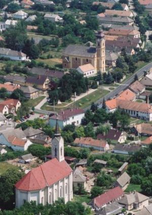
- Iregszemcse
-
Iregszemcse Location of Iregszemcse Coordinates: 46°41′52″N 18°10′50″E / 46.69768°N 18.18062°ECoordinates: 46°41′52″N 18°10′50″E / 46.69768°N 18.18062°E Country  Hungary
County Tolna Area - Total 58.33 km2 (22.5 sq mi) Population (2004) - Total 2,796 - Density 47.93/km2 (124.1/sq mi) Time zone CET (UTC+1) - Summer (DST) CEST (UTC+2) Postal code 7095 Area code(s) 74 Iregszemcse (means Ireg-Szemcse) is a village in Tolna County, Hungary.
Contents
History
Two villages Felső-Ireg and Szemcséd was jointed in 1938.
Districts
- Új Élet
- Rákóczi
- Újbarázda
Nearby municipalitiea
- Csehi-Puszta
- Okrádpuszta
- Új-Ireg
- Nagy-Szokoly
- Medgyespuszta
- Fornádpuszta
Sights
- Viczay-Kornfeld Castle (Hungarian: Viczay-Kornfeld kastély) (1820)
- Kornfeld Castle (Hungarian: Kornfeld kastély):
- Kálvária-kápolna: 15th-century gothic temple
External links
- Street map (Hungarian)
Categories:- Populated places in Tolna county
- 1263 establishments
- 1938 establishments
- Viczay family
- Hungarian history stubs
- Tolna geography stubs
Wikimedia Foundation. 2010.


