Flinders Group National Park
- Flinders Group National Park
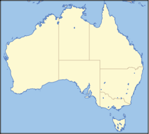
Infobox_protected_area_of_Australia | name = Flinders Group National Park
iucn_category = II
caption =
locator_x = 212
locator_y = 25
nearest_town_or_city = Cooktown
coordinates = coord|14|04|25|S|144|15|21|E|type:landmark_region:AU
area = 29.7 km²
established = 1939
visitation_num =
visitation_year =
managing_authorities = Queensland Parks and Wildlife Service
official_site = [http://www.epa.qld.gov.au/projects/park/index.cgi?parkid=207 Flinders Group National Park]
Flinders Group is a national park in Queensland (Australia), 1745 km northwest of Brisbane.
ee also
* Protected areas of Queensland (Australia)
Wikimedia Foundation.
2010.
Look at other dictionaries:
Flinders Chase National Park — Infobox protected area of Australia | name = Flinders Chase National Park iucn category = II caption = locator x = 162 locator y = 184 nearest town or city = Kingscote coordinates = coord|35|58|38|S|136|40|22|E| area = 328 km² [ [http://www.parks … Wikipedia
Flinders Island (Queensland) — Flinders Island is part of the Great Barrier Reef Marine Park at the tip of Cape Melville, Queensland in Bathurst Bay.It is north of Denham Island in the Flinders Group National Park. It is separated from Stanley Island by Owen Channel and… … Wikipedia
Coffin Bay National Park — IUCN Category II (National Park) … Wikipedia
Naracoorte Caves National Park — Skeleton of a Marsupial Lion (Thylacoleo carnifex) in the Victoria Fossil Cave, Naracoorte Caves National Park Naracoorte Caves National Park IUCN Category II ( … Wikipedia
Drovers Cave National Park — IUCN Category II (National Park) … Wikipedia
Onkaparinga River National Park — IUCN Category II (National Park) … Wikipedia
Mount Walsh National Park — IUCN Category II (National Park) Mount Walsh Nearest town/city Biggenden, Queensland Coordinates … Wikipedia
Curtis Island National Park — IUCN Category II (National Park) Coordinates 23°31′49″S 151°13′16″E … Wikipedia
Mungkan Kandju National Park — IUCN Category II (National Park) … Wikipedia
Wilsons Promontory National Park — Infobox protected area of Australia | name = Wilsons Promontory National Park iucn category = II caption = locator x = 226 locator y = 211 nearest town or city = Yanakie coordinates = coord|38|46|24|S|146|16|36|E|type:landmark region:AU area = 90 … Wikipedia
