- Osztopán
-
Osztopán Location of Osztopán
 Osztopán
Coordinates: 46°31′13″N 17°40′14″E / 46.52032°N 17.67068°ECoordinates: 46°31′13″N 17°40′14″E / 46.52032°N 17.67068°E Country  Hungary
County Somogy Area – Total 22.83 km2 (8.8 sq mi) Population (2004) – Total 844 – Density 36.96/km2 (95.7/sq mi) Time zone CET (UTC+1) – Summer (DST) CEST (UTC+2) Postal code 7444 Area code(s) 82 Osztopán is a village in Somogy county, Hungary.
External links
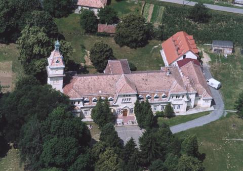
 Osztopn, palace from above
 Categories:
- Somogy geography stubs
- Populated places in Somogy county

Wikimedia Foundation. 2010.