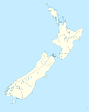
North Cape, New Zealand

North Cape, New Zealand
North Cape is located in New Zealand
{{{alt}}}
North Cape

North Cape is located at the northern end of the North Auckland Peninsula in the North Island of New Zealand . It is the northeastern tip of the Aupouri Peninsula and lies 30 km east of Cape Reinga. The name is sometimes used to refer just to the cape which is known in Māori as Otou and which overlooks Murimotu Island, and sometimes just to the eastern point of Murimotu Island.[1] It is also used to refer to the whole larger headland stretching about five km from Murimotu Island westwards to Kerr Point (Ngatuatata) and including the Surville Cliffs. This wider North Cape, and specifically the Surville Cliffs, is the northernmost point of mainland New Zealand, being about three km further north than Cape Reinga. This article covers the wider North Cape.

North Cape was once an island formed by a marine volcano. Sand deposited by ocean currents eventually formed a tombolo known as Waikuku Flat which joined the island to the rest of the Aupouri Peninsula. The headland and flat combined now form the North Cape Peninsula.

A large part of North Cape is enclosed in the North Cape Scientific Reserve. The reserve’s purpose is to protect the unique flora and fauna of the area, some of it endemic to a small area on Surville Cliffs. An electrified fence was erected in 2000 to create a mainland island by excluding the possums, feral pigs and semi-wild horses of the area. The reserve is closed to the public and managed by the Department of Conservation (DoC).

Much of Waikuku Flat is in another DoC reserve, the Mokaikai Scenic Reserve which stretches south to Parengarenga Harbour. This reserve is open to the public but land access is via an area in Māori tribal ownership and a permit is required from the controlling Māori body to cross the land. Another strip of Māori land lies between the Mokaikai reserve and the North Cape reserve. This strip includes the southern part of North Cape and the northern edge of Waikuku Flat. It stretches from Kerr Point and the north end of Tom Bowling Bay on the north coast across to Tokatoka Point on the west coast.

References

  1. ^ Hooker, Brian (2002). "The problem of North Cape, New Zealand, in maps" ([dead link]). New Zealand Map Society Journal 15: 47–49. Archived from the original on November 2, 2007. http://web.archive.org/web/20071102090616/http://www.findingnz.co.nz/ap/hap1_problem_of_nth_in_maps.htm. Retrieved 2007-12-13. 

Coordinates: 34°24′56″S 173°03′04″E / 34.415463°S 173.051111°E / -34.415463; 173.051111


Wikimedia Foundation. 2010.

Игры ⚽ Поможем сделать НИР

Look at other dictionaries:

  • North Cape — may refer to: North Cape, Prince Edward Island North Cape, New Zealand North Cape, Norway, also known as Nordkapp North Cape, Wisconsin, an unincorporated community North Cape (ship), a barge which ran aground in Rhode Island in 1996, causing a… …   Wikipedia

  • North Cape (Neuseeland) — Lage des North Cape Das North Cape liegt im äußersten Nordosten der Aupouri Peninsula, des nördlichen Ausläufers der North Auckland Peninsula der Nordinsel Neuseelands. Seine Nordostspitze liegt 30 km östlich von der Nordwestspitze der Halbinsel… …   Deutsch Wikipedia

  • North Cape — Lage des North Cape Das North Cape liegt im äußersten Nordosten der Aupouri Peninsula, des nördlichen Ausläufers der North Auckland Peninsula der Nordinsel Neuseelands. Seine Nordostspitze liegt 30 km östlich von der Nordwestspitze der Halbinsel… …   Deutsch Wikipedia

  • New Zealand wars — New Zealand Land Wars Memorial in the Auckland War Memorial Museum for those who died, both European and Māori, in the New Zealand Wars. Kia mate toa can be translated as fight unto death or be strong in death , and is the motto of the …   Wikipedia

  • Main North Line, New Zealand — Main North Line Start of the Main North Line, heading north under the old Blenheim Road overpass in the distance, and to the left under the new Blenheim Road overpass to Christchurch railway station. Overview Type …   Wikipedia

  • New Zealand State Highway 1 — State Highway 1 Route information Maintained by …   Wikipedia

  • New Zealand land wars — Infobox Military Conflict conflict = New Zealand Land Wars partof = caption = Memorial in the Auckland War Memorial Museum for those who died, both European and Māori, in the New Zealand Wars. Kia mate toa can be translated as fight unto death or …   Wikipedia

  • North Cape — geographical name 1. cape New Zealand at N tip of North Island 2. cape NE Norway on Mageröy Island at 71°10′20″N 3. see horn …   New Collegiate Dictionary

  • North Cape — 1. a point of land on an island at the N tip of Norway: the northernmost point of Europe. 2. the northern end of North Island, New Zealand. * * * a promontory on Magerøya, an island off the northern coast of Norway. North Cape is the northernmost …   Useful english dictionary

  • North Cape — 1. a point of land on an island at the N tip of Norway: the northernmost point of Europe. 2. the northern end of North Island, New Zealand. * * * …   Universalium

Share the article and excerpts

Direct link
Do a right-click on the link above
and select “Copy Link”