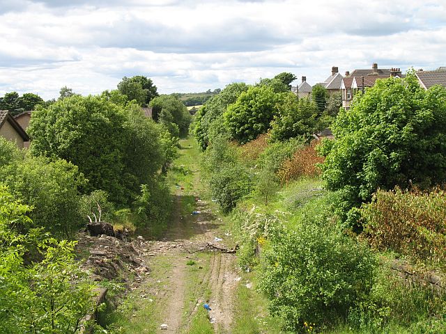
Caldercruix railway station
- Caldercruix railway station
Infobox UK disused station
name = Caldercruix
other_name =

caption = Caldercruix railway station in 2008
code =
original = Bathgate and Coatbridge Railway
pregroup = North British Railway
postgroup = LNER
locale = Caldercruix
borough = North Lanarkshire
latitude =
longitude =
platforms = 2
years = 11 August 1862
events = Opened[Butt (1995), page 51] ]
years1 = 9 January 1956
events1 = Closed
years2 = 2010
events2 = Proposed reopening
years3 =
events3 =
years4 = |
Caldercruix railway station was a railway station seving Caldercruix, North Lanarkshire, Scotland. It was on the Bathgate and Coatbridge Railway. The station closed in 1956.
History
Future developement
Recently there have been plans, as part of the Airdrie-Bathgate Rail Link to reopen this station. Currently this station is under reconstruction. The Airdrie-Bathgate rail link is a new project created to enable Glasgow and Edinburgh to be linked via a fourth route by reopening the railway between the towns of Airdrie and Bathgate.
rail line
next = Drumgelloch
previous = Armadale
route = First ScotRail
Airdrie-Bathgate Rail Link
col = FF80C0rail line
next = Plains
Line and Station closed
previous = Forrestfield
Line and Station closed
route = Bathgate and Coatbridge Railway
North British Railway
col = NBR colour
###@@@KEYEND@@@###
References
Notes
Sources
*
*
* Airdrie-Bathgate Rail Link
* [http://www.railscot.co.uk/Bathgate_and_Coatbridge_Railway/frame.htm RAILSCOT on Bathgate and Coatbridge Railway]
* [http://www.disused-stations.org.uk/ Disused stations]
Wikimedia Foundation.
2010.
Look at other dictionaries:
Drumgelloch railway station — Drumgelloch Scottish Gaelic: Druim Gailleach … Wikipedia
Armadale railway station, West Lothian — Infobox UK disused station name = Armadale other name = caption = original = Bathgate and Coatbridge Railway pregroup = North British Railway postgroup = LNER locale = Armadale borough = West Lothian latitude = longitude = platforms = 2 years =… … Wikipedia
Caldercruix — infobox UK place| official name= Caldercruix gaelic name= scots name= local name= country= Scotland population= os grid reference= NS8268 latitude= 55.89 longitude= 03.88 post town= AIRDRIE postcode area= ML postcode district= ML6 dial code=… … Wikipedia
Cleland, North Lanarkshire — Cleland is a small village near Motherwell, North Lanarkshire, Scotland see [1]. The two nearest towns are Wishaw and Motherwell. The village has a strong mining heritage and is a typical example of a working class village in North Lanarkshire… … Wikipedia
Motherwell — For other uses, see Motherwell (disambiguation). Coordinates: 55°47′02″N 3°59′07″W / 55.78396°N 3.98522°W / 55.78396; 3.98 … Wikipedia
Cumbernauld — Coordinates: 55°56′N 3°59′W / 55.94°N 3.98°W / 55.94; 3.98 … Wikipedia
Bellshill — This article is about the town in North Lanarkshire, Scotland. For other places of the same name, see Bellshill (disambiguation). Coordinates: 55°48′59″N 4°01′34″W / 55.81647°N 4 … Wikipedia
Muirhead — For other uses, see Muirhead (disambiguation). Muirhead (Scots: Mairheid, Scottish Gaelic: Ceann a Mhonaidh)[1] is a small suburb about 7 miles North East of Glasgow city centre. Nearby villages and towns include Chryston, Stepps, Lenzie,… … Wikipedia
North Clyde Line — North Clyde Line A Class 334 crosses the River Leven between Dumbarton and Dalreoch … Wikipedia
Airdrie-Bathgate Rail Link — The Airdrie Bathgate Rail Link is a proposed railway development in Central Scotland.Instigated as part of a round of transport improvement projects proposed by the Scottish Executive in 2003, the plan is intended to open up a fourth direct… … Wikipedia

