Kaknästornet

Kaknästornet

Infobox Modern building


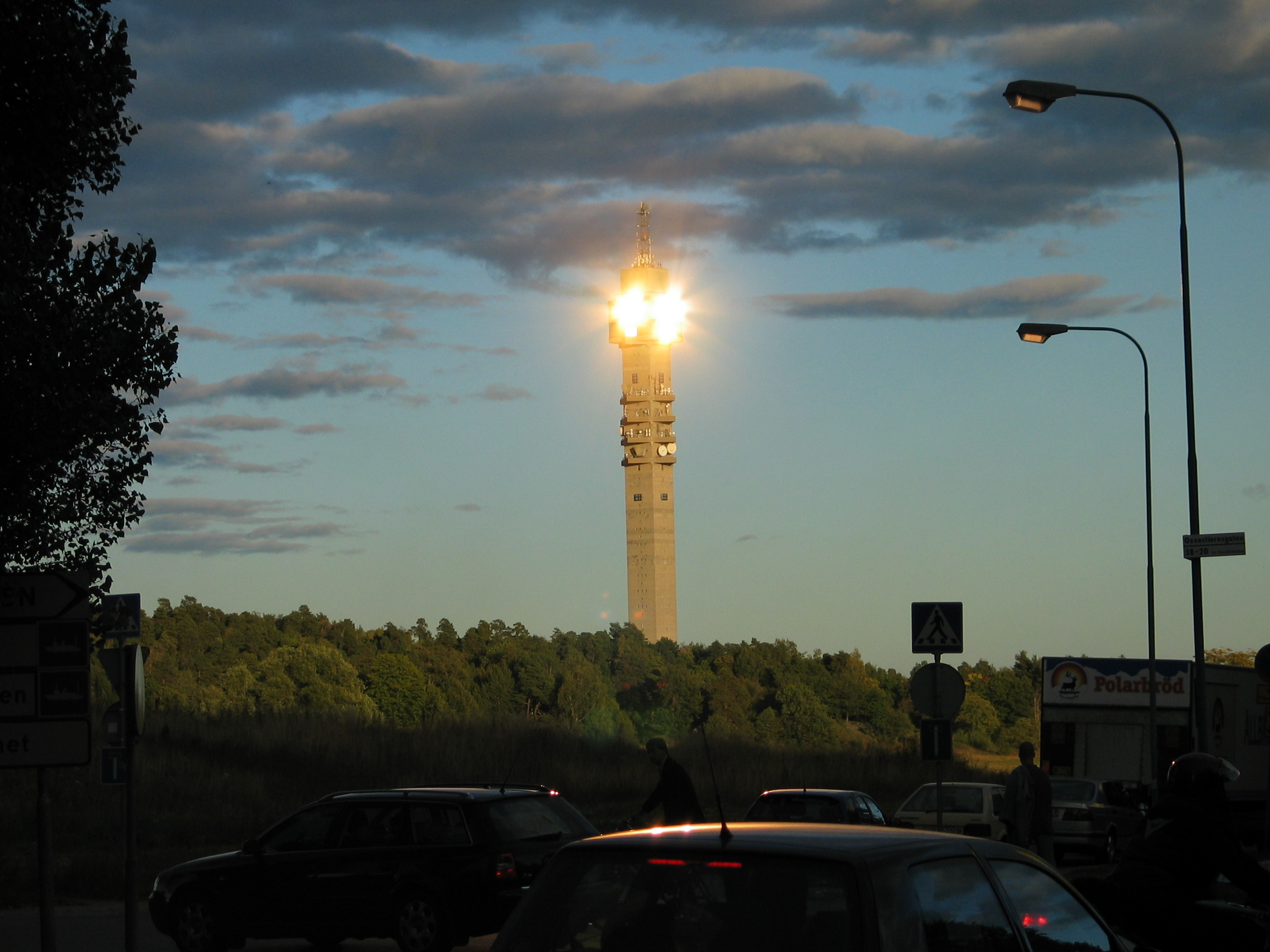
caption=View of the TV Tower
name=Kaknästornet
location_town=Stockholm
location_country=Sweden
architect=Hans Borgström
Bengt Lindroos
client=
engineer=
construction_start_date=1963
completion_date=1967
date_demolished=
cost=
structural_system=
style=Neo brutalism|

The Kaknäs tower (Swedish: Kaknästornet) is a TV tower in Stockholm, Sweden, at coord|59|20|06|N|18|07|35|E|type:landmark_region:SE|display=inline,title. The tower is a major hub of Swedish television, radio and satellite broadcasts. It was finished in 1967, designed by architect Bengt Lindroos, and the height is 155 meters (including antenna 170 meters). For many years Kaknästornet was the tallest building in ScandinaviaFact|date=September 2007, but it was surpassed in 2000 by the Kista Science Tower in north Stockholm, a mere three meters tallerFact|date=September 2007, which in turn was surpassed by Turning Torso in Malmö in 2005. The tower is owned by the national Swedish broadcasting company Teracom. It can not communicate with some southern satellites due the environmental orders that protect the ancient oak trees owned by the King of Sweden.Fact|date=July 2008 These block the "line-of-sight".

The tower is open to the public, with information centre/gift shop, indoor and outdoor observation decks as well as a restaurant. The tower affords superb views of Stockholm city to the west and Stockholm archipelago to the east. Weekdays the restaurant offers "dagens" or "the days meal" which is affordable eating for most tourists. Booking at the restaurant allows free (otherwise chargeable) access to fantastic views.

Popular culture

*The tower appears in the SVT1 (a.k.a. Kanal1) ident from 1988.

External links

* [http://www.stockholmtown.com/templates/Museum___5881__EN.aspx Information from Stockholm Town]
* [http://www.teracom.se/?page=5405 Information from Teracom] sv icon
*


Wikimedia Foundation. 2010.

Игры ⚽ Поможем решить контрольную работу

Look at other dictionaries:

  • Kaknästornet — 59°20′6″N 18°07′37″E / 59.335, 18.12694 …   Wikipédia en Français

  • Kaknästornet — Kaknästurm Basisdaten Ort: Stockholm Verwendung: Fernsehturm Bauzeit: 1964–1967 …   Deutsch Wikipedia

  • Svenska Filminstitutet — Eingang des Schwedischen Filminstitutes in Östermalm, Stockholm Das Studiogebäude, Kaknä …   Deutsch Wikipedia

  • Kaknästurm — Basisdaten Ort: Stockholm Verwendung: Fernsehturm Bauzeit: 1964–1967 …   Deutsch Wikipedia

  • Östermalm — Lage von Östermalm im Stockholmer Stadtgebiet Skulptu …   Deutsch Wikipedia

  • Riddarfjärden — Riddarfjärden, literally the Knight Firth , is a bay of Lake Mälaren in central Stockholm. Stockholm was founded in 1252 on an island in the stream where Lake Mälaren (from the west) drains into the Baltic Sea (to the east). The island is today… …   Wikipedia

  • 1967 in architecture — The year 1967 in architecture involved some significant events.Buildings* Habitat 67 in Montreal, Canada designed by Moshe Safdie as part of Expo 67. * Marina City in Chicago, designed by Bertrand Goldberg is opened. * The Ostankino Tower in… …   Wikipedia

  • List of tallest buildings and structures in the world by country — This is a list of the tallest buildings and structures by country. The list directly includes the tallest buildings and structures for each country, and where appropriate, it also points to more detailed country specific… …   Wikipedia

  • Nordic Museum — This article is about the Nordic Museum in Stockholm. For the Nordic Museum in the Ballard district of Seattle, Washington see Nordic Heritage Museum. Nordic Museum Nordiska museet The Nordic Museum as seen from …   Wikipedia

  • Hagalund — For Hagalund, Espoo, see Tapiola. Hagalund is a residential area and railway yard in Solna Municipality, 5km north of central Stockholm. It is known for the blue skyscrapers Blåkulla (Blue Hill) which, against a rather strong and long lasting… …   Wikipedia

Share the article and excerpts

Direct link
Do a right-click on the link above
and select “Copy Link”