- Húsar
Infobox Settlement
official_name = Húsar
other_name =
native_name =
nickname =
settlement_type =Village
motto =
imagesize =
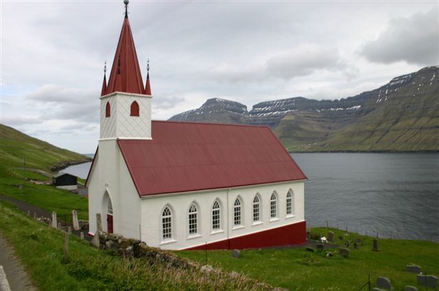
image_caption = Church of Húsar
flag_size =
image_
seal_size =
image_shield =
shield_size =
city_logo =
citylogo_size =
mapsize =
map_caption =
mapsize1 =
map_caption1 =
image_dot_
dot_mapsize =
dot_map_caption =
dot_x = |dot_y =
pushpin_
pushpin_label_position =
pushpin_map_caption =
pushpin_mapsize =
subdivision_type = Country
subdivision_name =Kingdom of Denmark
subdivision_type1 = Autonomous province
subdivision_name1 =Faroe Islands
subdivision_type2 = Municipality
subdivision_name2 = Húsar
subdivision_type3 =
subdivision_name3 =
subdivision_type4 =
subdivision_name4 =
government_footnotes =
government_type =
leader_title =
leader_name =
leader_title1 =
leader_name1 =
leader_title2 =
leader_name2 =
leader_title3 =
leader_name3 =
leader_title4 =
leader_name4 =
established_title =
established_date =
established_title2 =
established_date2 =
established_title3 =
established_date3 =
area_magnitude =
unit_pref =
area_footnotes =
area_total_km2 =
area_land_km2 =
area_water_km2 =
area_total_sq_mi =
area_land_sq_mi =
area_water_sq_mi =
area_water_percent =
area_urban_km2 =
area_urban_sq_mi =
area_metro_km2 =
area_metro_sq_mi =
area_blank1_title =
area_blank1_km2 =
area_blank1_sq_mi =
population_as_of =
population_footnotes =
population_note =
population_total =55
population_density_km2 =
population_density_sq_mi =
population_metro =
population_density_metro_km2 =
population_density_metro_sq_mi =
population_urban =
population_density_urban_km2 =
population_density_urban_sq_mi =
population_blank1_title =
population_blank1 =
population_density_blank1_km2 =
population_density_blank1_sq_mi =
timezone =
utc_offset =
timezone_DST =
utc_offset_DST =
latd=61 |latm=16 |lats=4 |latNS=N
longd=6 |longm=40 |longs=53 |longEW=W
coordinates_display = inline,title
coordinates_type = type:city_region:FO
elevation_footnotes =
elevation_m =
elevation_ft =
postal_code_type = Postal code
postal_code =FO 796
area_code =
blank_name =
blank_info =
blank1_name =
blank1_info =
website =
footnotes = Húsar is a village on the East side ofKalsoy ,Faroe Islands . It is the oldest of the villages on Kalsoy. The church, which is made of stone, was built in 1920. Húsar is connected toKlaksvík by a ferry that visits the village three times a day. From Húsar the other villages on the island can be reached by bus.Húsar is also involved in
fish farming , particularly the production of fry. The fry is grown for 1½ to 2 years. After that it is placed in sea farms where it will grow into fish. Húsar also has a cutler who produces exquisite handmade knives for whale slaughtering.See also
*
List of towns in the Faroe Islands External links
* [http://www.faroeislands.dk/pages/HusarIndex.htm Faroeislands.dk: Húsar] Images and description of all cities on the Faroe Islands.
Wikimedia Foundation. 2010.
