Funningur

Funningur

Infobox Settlement
official_name = Funningur


mapsize = 100px
population_total = 79
population_as_of = December 31, 2002
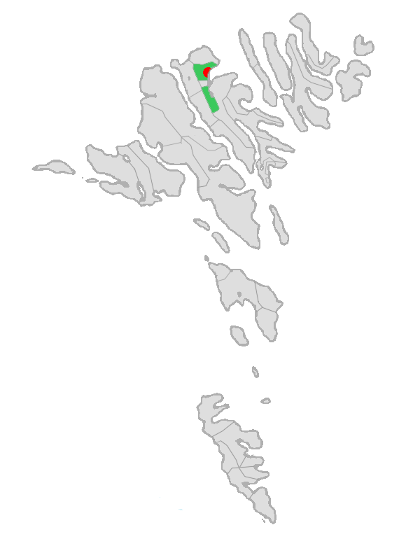
postal_code = FO 475

Funningur is a town on the Faroe Islands. It is located on the north-west coast of Eysturoy (coord|62|17|17|N|6|58|2|W|). It is the only village in the municipality called "Funnings kommuna", which on 1 January 2009 will become part of Runavíkar kommuna.

To the west of the village rises the highest mountain in the Faroe Islands: Slættaratindur (882m).

Tradition says that the first viking who settled on the Faroe Islands settled in Funningur. His name was Grímur Kamban, a Norwegian Viking escaping the tyranny of the Norse king Haraldur Hárfagri. However, this is an error in this saga, because Harald's age was in the late 9th century, while the first Norse settlers reached the Faroes after 825. (Actually, Irish monks arrived much earlier ca. 625–650).

About 110 people live in Funningur on both sides of a cascading stream in a compact cluster of houses around a small bay. The wooden turf-roofed church in Funningur dates from 1847 and stands at the water's edge.cite book|first=Don|last=Brandt|title=More Stamps and Story of the Faroe Islands|url=http://www.faroestamps.fo/download/stamps_i_england-22.pdf|format=pdf|accessdate=2008-09-04|volume=1|origyear=2006|publisher=Postverk Føroya|location=Tórshavn|isbn=99918-3-191-6|pages=43]

Mountains surrounding the village (counter-clockwise):

* Middagsfjall (601m) (due north)
* Gráfelli (856m)
* Slættaratindur (882m) (due west)
* Vaðhorn (780m)
* Blámansfjall (792m) with outcropping Nón (504m)
* Húsafjall (697m) (due south)

References

ee also

* List of towns in the Faroe Islands

External links

* [http://www.faroeislands.dk/pages/FunningurIndex.htm Faroeislands.dk: Funningur] Images and description of all cities on the Faroe Islands.


Wikimedia Foundation. 2010.

Игры ⚽ Поможем решить контрольную работу

Look at other dictionaries:

  • Funningur — Funningur …   Deutsch Wikipedia

  • Funningur — Funningur …   Wikipedia Español

  • Funningur — est une commune administrative des îles Féroé situé sur la côte nord ouest de l île d Eysturoy. Population: 79 code postal: FO 475 coordonnées: 62°17′17″N 6°58′2″O / …   Wikipédia en Français

  • Funningur Church — The church in Funningur was inaugurated on 30 November 1847. It is the youngest of the traditional Faroese wooden churches.List of Faroese churches …   Wikipedia

  • Färöische Holzkirche — Die alte Holzkirche von Gøta stammt von 1833 und wurde bei ihrem 100. Jahrestag als die älteste ihrer Art angesehen. Die Bewohner von Hvalvík wussten es …   Deutsch Wikipedia

  • Runavik — Logo Karte (ab 2005) Basisdaten Fläche: 29 km² (Kommune 2004) Einwohner (2007): 470 (Kommune: 3.678) Bevölkerungsdichte: 88 Ew./km² (Kommune 2002) …   Deutsch Wikipedia

  • Runavíkar kommuna — Logo Karte (ab 2005) Basisdaten Fläche: 29 km² (Kommune 2004) Einwohner (2007): 470 (Kommune: 3.678) Bevölkerungsdichte: 88 Ew./km² (Kommune 2002) …   Deutsch Wikipedia

  • Grímur Kamban — was, according to the Færeyinga saga, the first man to set foot in the Faroe Islands. The name was written Grímr in Old Norse and is often referred to as Grim in the English literature.The saga says, he was a Norwegian Viking escaping the tyranny …   Wikipedia

  • Ort der Färöer — Färöerkarte mit allen Orten. Die Färöer sind seit der Autonomie 1948 eine Nation innerhalb Dänemarks. Dort befinden sich folgende Orte mit über 1000 Einwohnern: Tórshavn: 16.955 (mit Argir und Hoyvík) Klaksvík: 4.666 Fuglafjørður: 1.558 …   Deutsch Wikipedia

  • Orte der Färöer — Färöerkarte mit allen Orten. Die Färöer sind seit der Autonomie 1948 eine Nation innerhalb Dänemarks. Dort befinden sich folgende Orte mit über 1000 Einwohnern: Tórshavn: 16.955 (mit Argir und Hoyvík) Klaksvík: 4.666 Fuglafjørður: 1.558 …   Deutsch Wikipedia

Share the article and excerpts

Direct link
Do a right-click on the link above
and select “Copy Link”