Thiel Mountains

Thiel Mountains

Geobox|Range
name=Thiel Mountains


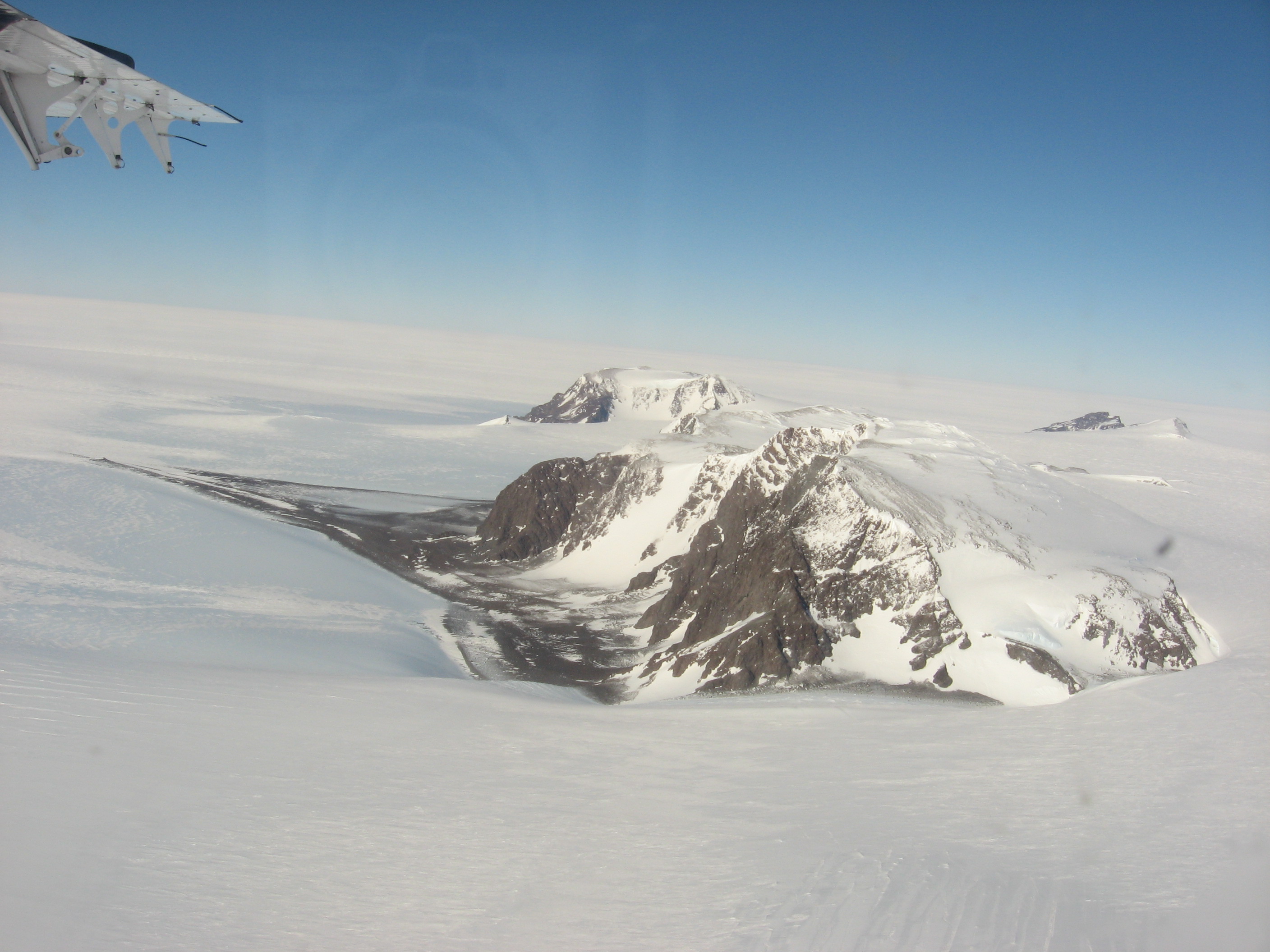
image_caption=Aerial view of the Thiel Mountains
country=Antarctica | country_type=Continent
region_type =
region=
parent=Transantarctic Mountains
border=Horlick Mountains| border1=Pensacola Mountains
highest=
highest_elevation=
highest_lat_d=|highest_lat_m=|highest_lat_s=|highest_lat_NS=S
highest_long_d=|highest_long_m=|highest_long_s=|highest_long_EW=E
geology= | period=| orogeny=

The Thiel Mountains are an isolated, mainly snow-capped mountain range in Antarctica which are convert|72|km|mi|0|abbr=on long. The mountains are located roughly between the Horlick Mountains and the Pensacola Mountains, and extend from Moulton Escarpment on the west to Nolan Pillar on the east. Major components include Ford Massif (2,810 m), Bermel Escarpment and a group of eastern peaks near Nolan Pillar. The mountains were observed and first positioned by the USARP Horlick Mountains Traverse Party, 1958-59. The mountains were surveyed by the USGS Thiel Mountains parties of 1960-61 and 1961-62.gnis|id=15183|type=antarid]

The Thiel Mountains were named by US-ACAN after Edward C. Thiel, traverse seismologist at Ellsworth Station and the Pensacola Mountains in 1957. In December 1959, he made airlifted geophysical observations along the 88th meridian West, including work near these mountains. Thiel perished with four others on November 9 1961 in the crash of a P2V Neptune aircraft soon after take-off from Wilkes Station.

An aircraft fuel cache (coord|85|12|S|087|53|W|) is located near the Thiel Mountains for planes traveling between Patriot Hills and the Amundsen-Scott South Pole Station. [http://www.adventure-network.com/subsubpage.asp?navid=1&id=41 South Pole Flights] ]

References


Wikimedia Foundation. 2010.

Игры ⚽ Поможем сделать НИР

Look at other dictionaries:

  • Thiel — can refer to:* Adolf Thiel (1915 2001), German American engineer * Andreas Thiel (bishop), catholic bishop of Ermland * Andreas Thiel, German Handball player * Carl Thiel, American music producer * Ernest Thiel, Swedish banker and art collector * …   Wikipedia

  • Monts Thiel — Situation des monts Thiel Géographie Altitude 2 810 m, Anderson Summit Massif Chaîne Transantarctique Longueur …   Wikipédia en Français

  • Transantarctic Mountains — Geobox|Range name=Transantarctic Mountains image caption=The Transantarctic Mountains in northern Victoria Land near Cape Roberts country=Antarctica | country type=Continent region type = region= parent= border= highest=Mount Kirkpatrick highest… …   Wikipedia

  • Jones Mountains — The Jones Mountains (73º32´S 094º00´W) are an isolated group of mountains, trending generally east west for 43 km (27 mi), situated on the Eights Coast, Ellsworth Land, about 80 km (50 mi) south of Dustin Island. The charts of the USAS, 1939 41,… …   Wikipedia

  • Mendenhall Peak — (85°24′S 87°19′W / 85.4°S 87.317°W / 85.4; 87.317) is a peak (2,130 m) 0.5 nautical miles (0.9 km) west of Mount Wrather in the east part of the Th …   Wikipedia

  • Mount Walcott — (85°21′S 87°23′W / 85.35°S 87.383°W / 85.35; 87.383) is a mainly ice free mountain (2,155 m) located 2.5 nautical miles (4.6 km) east of Mount Powell in the east part of the …   Wikipedia

  • Mount Wrather — (85°23′S 87°14′W / 85.383°S 87.233°W / 85.383; 87.233) is a rock peak (2,095 m) 2.5 nautical miles (4.6 km) south southeast of Mount Walcott along the east margin of the …   Wikipedia

  • King Peak (Antarctica) — King Peak (coord|85|21|S|88|12|W|) is a rock peak (2,200 m) surmounting the east extremity of the Bermel Escarpment, 1.5 miles westnorthwest of Mount Powell, in the east part of the Thiel Mountains. The name was proposed by Peter Bermel and… …   Wikipedia

  • Hadley Peak — (coord|85|1|S|90|40|W|) is a peak (2,660 m) surmounting the escarpment at the north edge of Ford Massif in the Thiel Mountains. The name was proposed by Peter Bermel and Arthur Ford, co leaders of the United States Geological Survey (USGS) Thiel… …   Wikipedia

  • Chastain Peak — (85°10′S 94°35′W / 85.167°S 94.583°W / 85.167; 94.583) is a peak, 2,255 metres (7,400 ft) high, near the center of the Moulton Escarpment, at the western margin o …   Wikipedia

Share the article and excerpts

Direct link
Do a right-click on the link above
and select “Copy Link”